
Streets of the Industrial Era
Streets of the Industrial Era focuses on the history of the streets in and around what is now known as the Bulfinch Triangle Historic District in the West End. The exhibit is a study of the changes brought about in an area that was, and remains now, a hub of transportation. The push and pull of changing economics over time drove the different phases and stages of land making and caused its eventual transformation from a maritime hub into a center of industry.
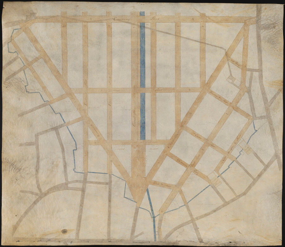
The Boston Garden and the area in front of the Garden was once marshland known as the North Cove. Millers of the settlement era created a dam at the opening of the North Cove, turning it into a Mill Pond used for milling. As the decades wore on, changing economics took the form of an increased need for land.
Charles Bulfinch (for whom the historic district is aptly named) oversaw and influenced many of the changes that led to the industrialization of the area. As the head of Boston’s board of selectmen, Bulfinch helped to plan and manage the early filling in of Mill Pond which took over 25 years (1807-1832). This involved excavating the top of Beacon and Pemberton Hills for clean fill. It was on this land that Bulfinch eventually oversaw the creation of the triangle, with Causeway Street forming its base. The South Margin and North Margin streets represented the margins of the former North Cove (although North Margin Street still exists in the North End, South Margin Street was removed during Urban Renewal in the 1950s.)