Mapping Amateur Radio Stations in the 1920s West End
Overlaying historic maps of the West End over a map of present-day Boston can contextualize the locations of amateur radio stations in the West End during the 1920s.
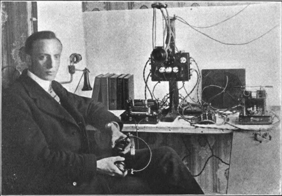
Leon W. Bishop, an early pioneer of amateur radio broadcasting, moved to 18 Irving Street in the West End in 1902. By 1920, large-scale radio broadcasts were first introduced to the United States with the presidential election results confirming the victory of Warren G. Harding. Since the enactment of the federal “Act to Regulate Radio Communication” in 1912, U.S. radio stations on land and sea had to receive licenses to operate, and the U.S. Department of Commerce proceeded to publish annual lists of licensed radio stations. Between 1920 and 1931, the Department of Commerce produced separate lists distinguishing commercial and government radio stations from amateur stations. Amateur radio operators in the West End participated in a nationwide, bottom-up effort to democratize information and communication in the United States.
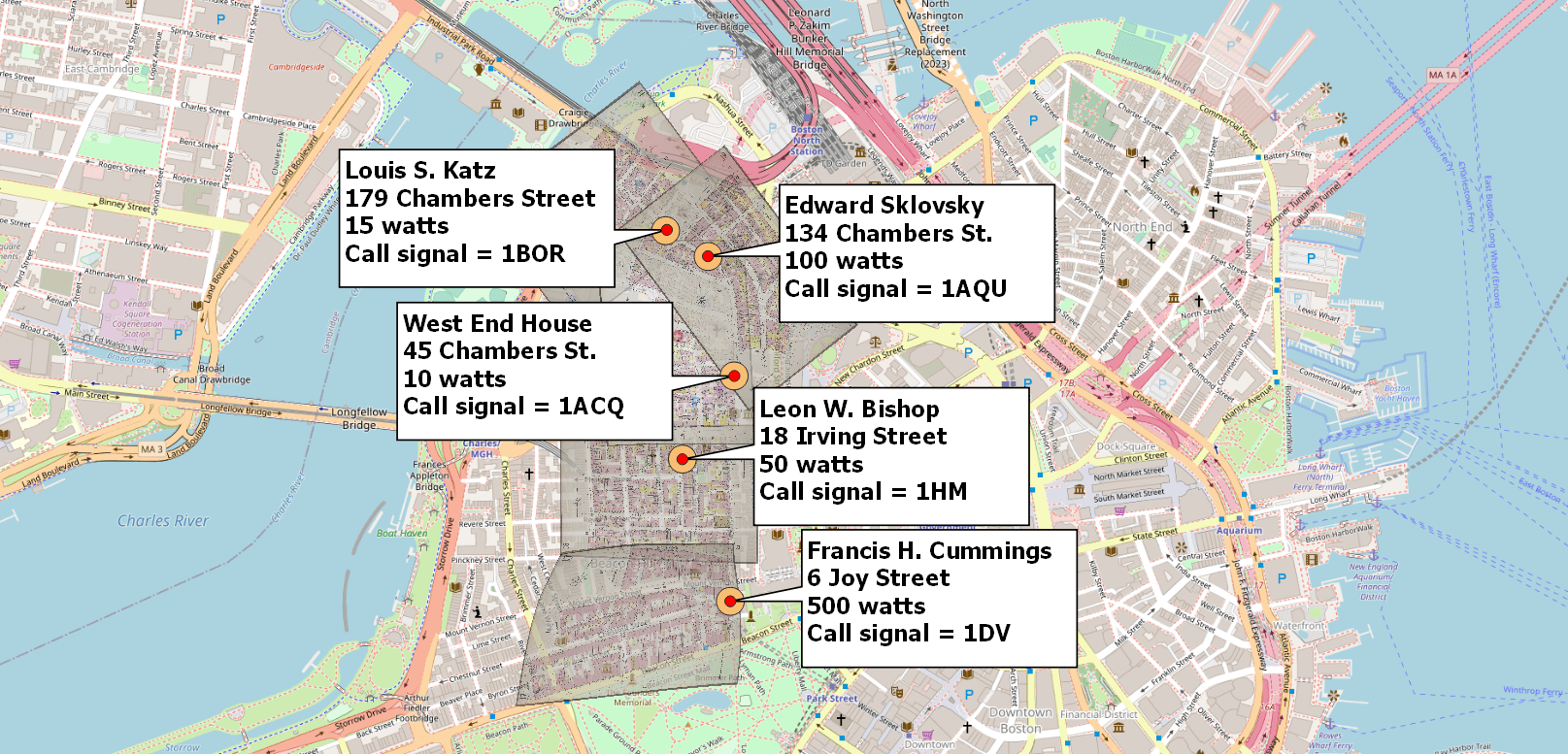
The 1922 edition of “Amateur Radio Stations of the U.S.” indicated that there were eighty-two amateur radio stations in Boston. Five of those stations, visualized in the “georectified map” below, were in the West End. The lists included names of radio operators, the addresses of their amateur stations, the signal strength of those stations (measured in watts), and their “call signals” (more commonly known as “call signs”). Call signals/signs are unique identifiers assigned by the Department of Commerce in alphabetical order once an amateur radio operator receives their license. In addition to the Commerce lists, the “Citizens’ Radio Call Book” of 1922 listed names, addresses, and call signals. One of the entries in the 1922 edition of the “Citizens’ Radio Call Book” includes the West End House’s amateur station on 45 Chambers St. The editor of Citizens’ Radio Call Book magazine wrote in 1928 that the original goal of the publication was “to supply the demand of the commercial and amateur operator for a Call Book containing all of the radio stations of the world.”
Georectified maps contextualize data from the past by overlaying historical visualizations over contemporary maps. With the freely available software called QGIS, researchers can align historical maps with contemporary Boston by pinpointing street corners and adjacent lots that have not changed. By adjusting the transparency of the images, the Sanborn maps blend in with present-day Boston and with each other.
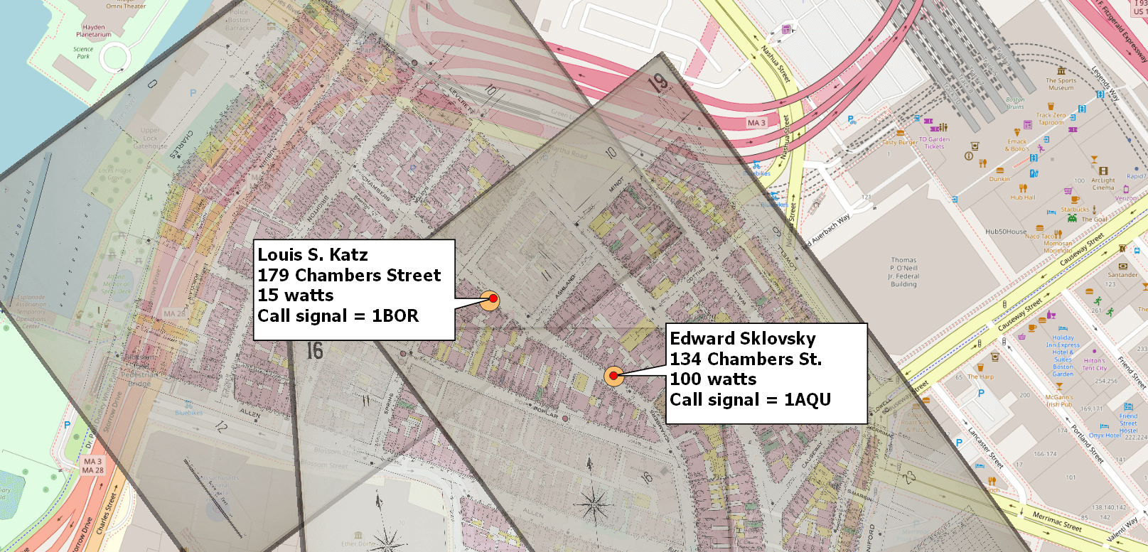
Historic maps are necessary to visualize the old West End because urban renewal in the late 1950s not only razed fifty acres of West Enders’ homes and businesses, it also changed the neighborhood’s streets. Chambers Street, which had three of the five amateur radio stations in the West End in 1922, was redesigned along with Allen Street and Green Street to create Cardinal O’Connell Way. Through the latest methods of digital history, The West End Museum can visualize addresses on streets that no longer exist in Boston.
The historic maps presented here were fire insurance maps produced by the Sanborn Map Company in 1909 (the closest year to 1922 for which Sanborn maps of the West End are publicly available). Because the Sanborn maps of the early twentieth century were published in a book, with limited page space, visualizations of an entire street (such as Chambers Street in the West End) often required multiple panels; this is why multiple panels intersect in the map above to produce a more complete picture.
Because the Sanborn fire insurance maps and the map of present-day Boston have different dimensions, sometimes the historic maps will look oddly stretched out. But this ensures that the visualizations are geographically consistent. As the panel below is curved, historic and present-day Beacon Street (as well as Boston Common, noted at the bottom of the Sanborn panel) are aligned.
Visualizations alone may not tell us more than we already know about the past, or much more than what we could articulate without maps. But georeferencing has a special significance for the history of old neighborhoods, such as the West End, that have largely been erased from maps today.
Article by Adam Tomasi
Source: Citizens’ Radio Call Book (1922), World Radio History, Sanborn Fire Insurance Maps from Boston, Suffolk County, Massachusetts (1909), Federal Communications Commission, West End Museum (“Street Names: Lost and Found,” “Leon W. Bishop”), Amateur Radio Stations of the U.S. (Department of Commerce, 1920), Brad Skopyk, “Georeferencing Historical Maps” (2021)


