Minot Street
Minot Street was one of the dozens of narrow, residential, West End streets razed by redevelopment in the 1950s. While the two street blocks on the northern side of the redevelopment zone were changed profoundly by urban renewal, the site’s rich history represents the constantly shifting geography of the Boston cityscape over the past two centuries.
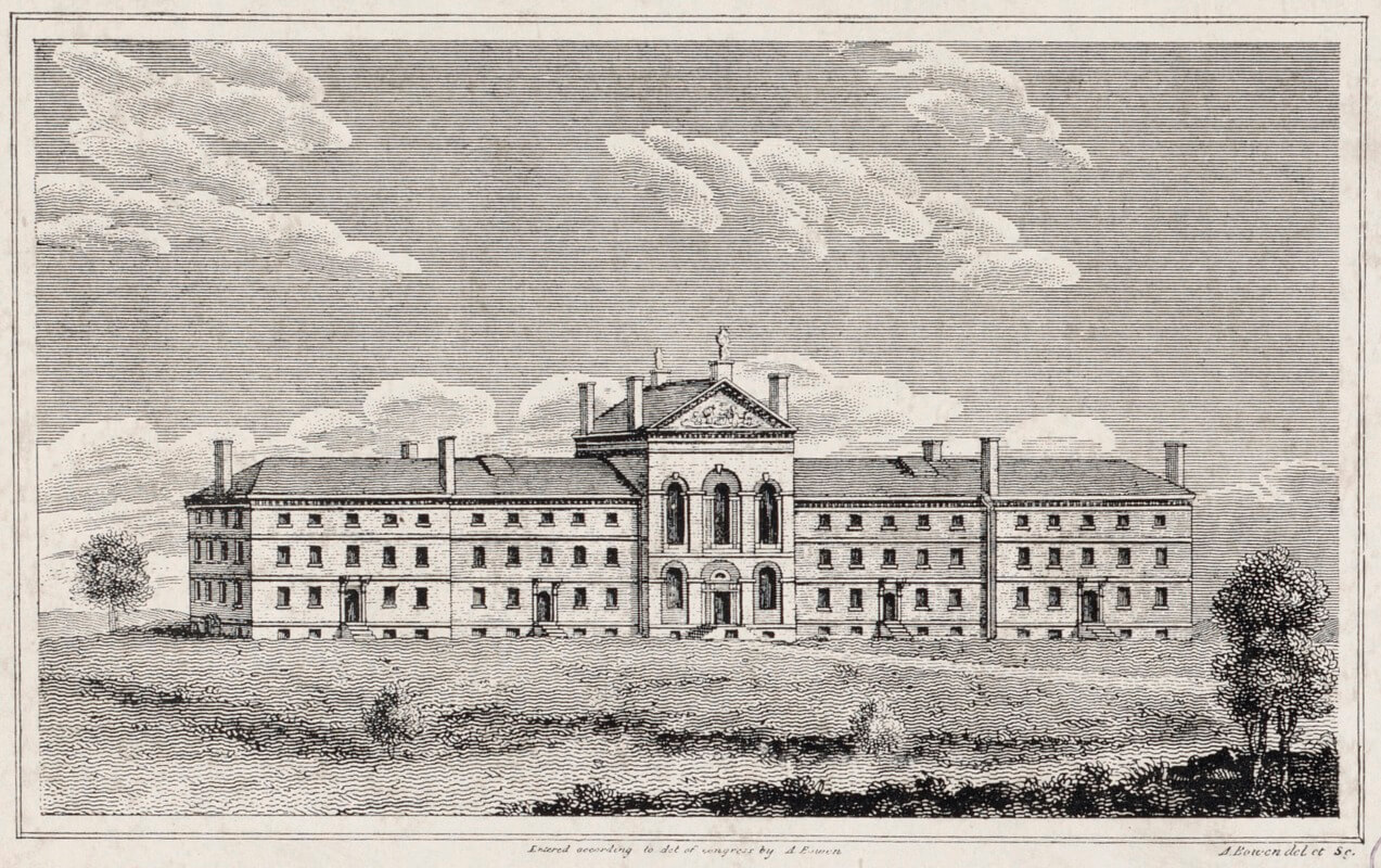
Minot Street was formed from a cart path that lay just south of the Leverett Street Almshouse, located at the edge of the Charles River between 1800 and 1825. The Federalist structure was designed by Charles Bulfinch, and ultimately met its demise when the Bulfinch Triangle was created by the filling of the Mill Pond and surrounding banks of the Charles River. After the destruction of the Almshouse, Cart Lane was renamed to Minot Street in 1825, most likely named after the wealthy Minot family which had ties to nearby Mass General Hospital. Minot Street extended to the river’s edge and parallel to Vernon Street and Barton Street. The newly built Leverett Street Jail occupied the space immediately to the south of these city blocks.
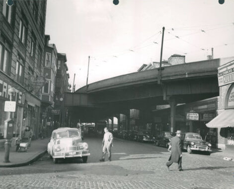
As Boston continued to grow, Minot Street took on the features of the city’s ever-changing streetscape. The street became a key location in the 1830s, with the construction of the Boston and Lowell Rail depot at its eastern terminus. The station remained an important freight depot for the Boston & Lowell railroad until the eventual consolidation of all local rail activity into Union Station on Causeway Street in the 1890s. Upon the removal of the Lowell depot, Lowell Street was created in its place, and around 1895 Minot Street was lengthened to intersect with Nashua Street. Between 1911 and 1917, the green steel elevated rail tracks that snaked above Boston’s streets were constructed along Causeway and up Lowell Street, intersecting Minot along the way.
Throughout its existence, Minot Street looked like most other streets in the West End, lined with brick rowhouse apartments that sat atop immigrant-owned businesses on its ground floors. Although records show that the West End population peaked around 1900 before declining throughout the 20th century, a 1922 Boston Business Directory paints a vibrant economic picture. The two short blocks between Leverett and Lowell Street housed a grocer, a restaurant, and laundromat to service the neighborhood, as well as a tailor and shoe repair shop. Services, including electricians and plumbers, were readily available, and multiple secondhand furniture stores and antique shops were supported by the steady stream of families who made their homes in the apartment units upstairs.
What remains of Minot Street today post-urban renewal? Not much. As shown in the image above, the location is now occupied by a dirt path behind Alcott Tower which connects to Thoreau Path, the winding pedestrian walkway between the other West End high-rise condominiums built in the 1980s. The modern-day aerial view also shows the Green Line going underground at Lomasney Way, tracing the path of the former elevated rail line. As for remaining structures, the area is survived only by the Last Tenement, whose former address at 42 Lowell Street was just steps from the corner of Minot.
The former site of Minot Street has seen many significant transformations: from Almshouse, to rail depot, to immigrant neighborhood, and most recently to an apartment community. While the negative effects of urban renewal are well-documented, Minot Street’s diverse history also points to the possibility that the area will continue to evolve to meet the needs of its citizens – this time with the benefit of lessons learned in the wake of the West End’s demolition.
Article by Meyer Aviles, edited by Grace Clipson.
Sources: https://www.universalhub.com/comment/261028#comment-261028; https://goodoldboston.blogspot.com/2011/06/lost-train-stations-boston-and-lowell.html; https://garystockbridge617.getarchive.net/amp/media/alms-house-leveret-street-c805ea (Alms House); Norman Leventhal Map Collection.; https://www.massmoments.org/moment-details/last-elevated-train-runs-in-boston.html; https://www.boston.gov/news/demolition-west-end; Boston Directory 1823-1826; https://ia601603.us.archive.org/5/items/bostoneventsbrie00sava/bostoneventsbrie00sava.pdf


