Kendall Square: Urban Renewal to the World’s “Most Innovative Square Mile”
The West End’s neighbor across the Charles River, Kendall Square, was designated an urban renewal project area. However, as federal involvement evaporated in the late 1960s, plans for a NASA compound would have to change. MIT stepped in to fill the urban renewal void.
Four Commonwealth cities – Boston, Cambridge, Salem, and Springfield – approved urban renewal plans in the 1960s. These projects varied greatly. This is the first in a series of articles on urban renewal across Massachusetts.
Much has been written about the impact of federal urban renewal projects in the city of Boston. The destruction of the West End neighborhood is likely the most well-known and well-documented urban renewal project in Boston, if not Massachusetts. In this period, resident displacement and wholesale neighborhood leveling were commonplace. The Kendall Square Urban Renewal Plan, approved in 1965, offers a compelling counter-narrative to the West End. It utilized the same federal tools and aggressive land-clearance tactics as its counterparts. Still, Kendall Square’s outcome was fundamentally altered by a shifting political climate, the presence of the Massachusetts Institute of Technology (MIT), and the unexpected arrival—and departure—of the federal government.
From Industrial to Blight
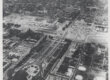
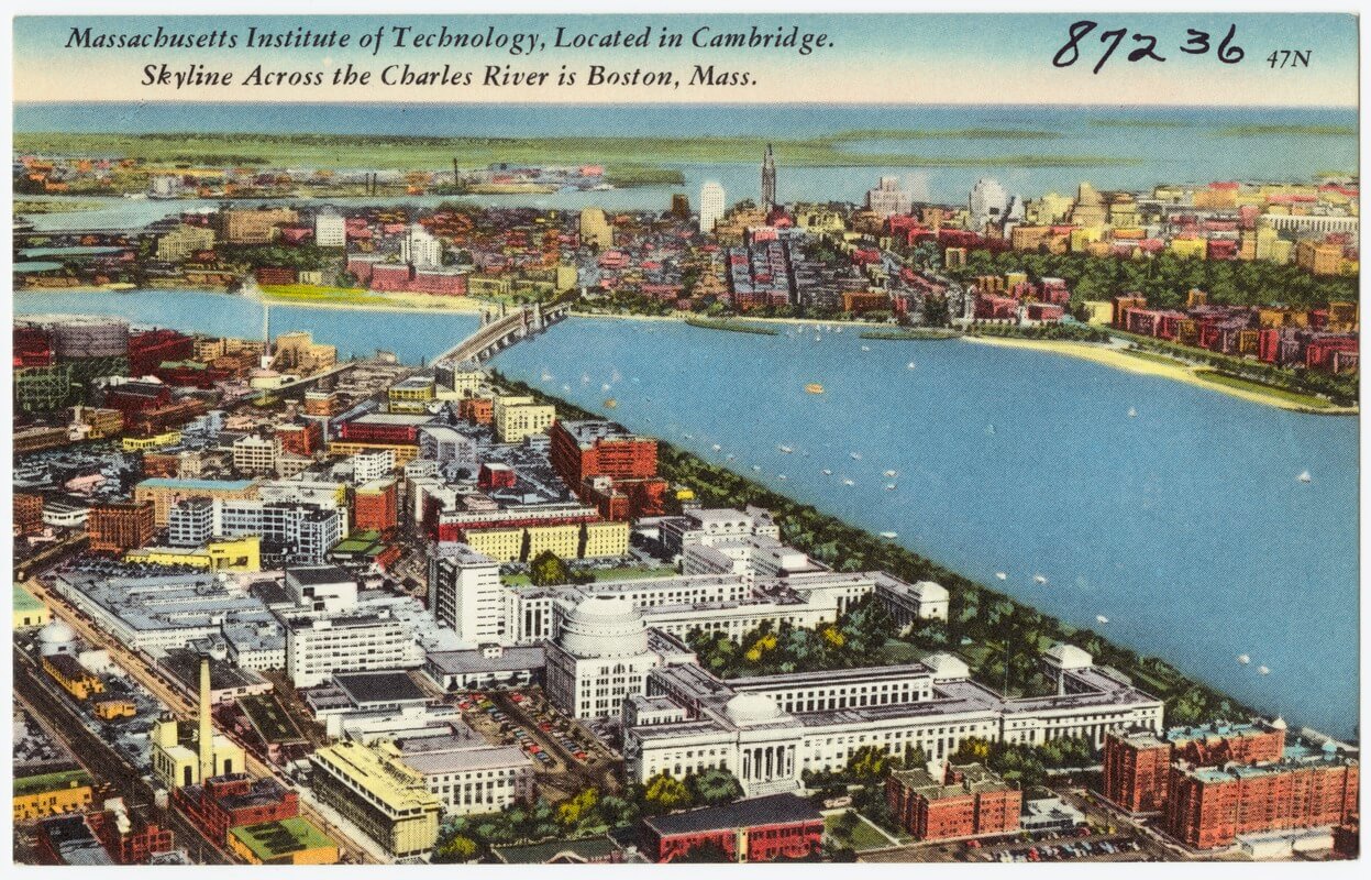
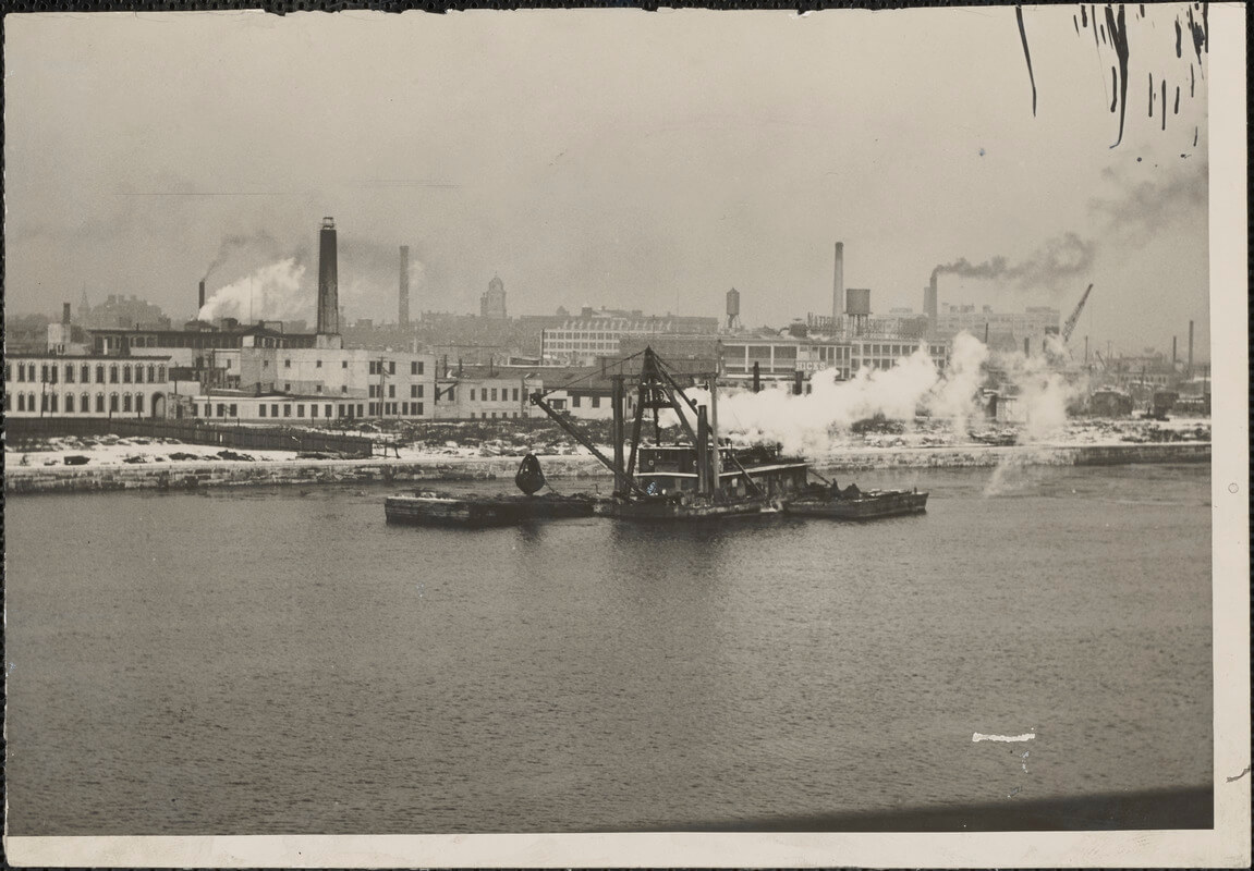
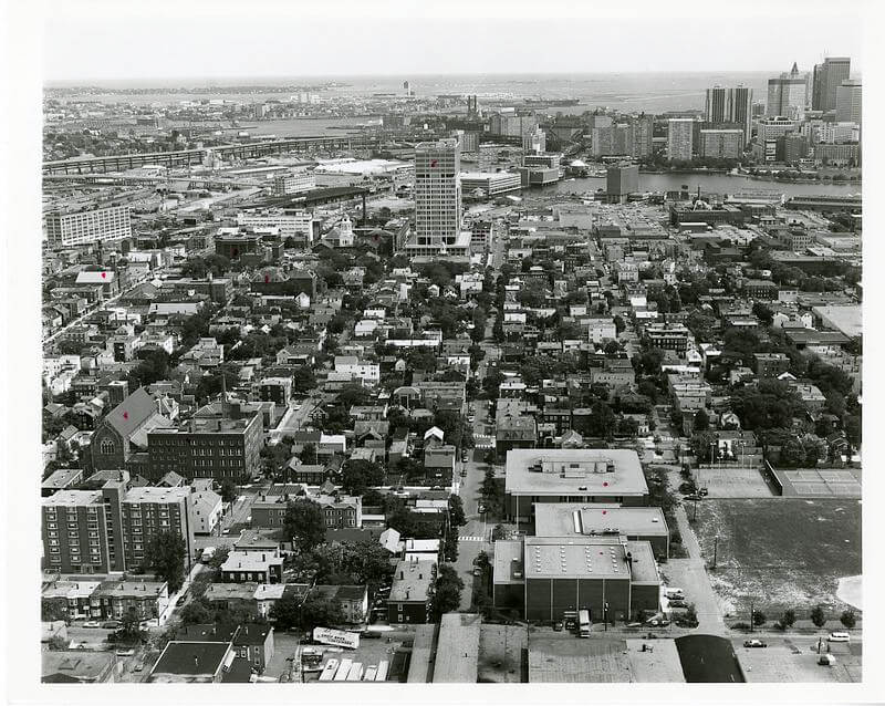
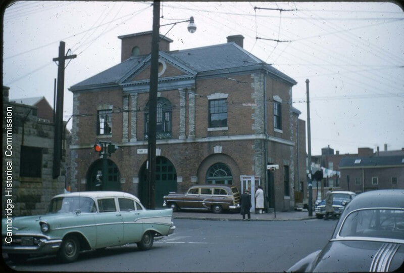
At the dawn of the 1960s, Kendall Square was far from the sleek, glassy innovation hub it is today. The square sits at the eastern edge of Cambridge, where the Charles River meets a complex web of rail lines. It served as a gritty engine for the regional economy. For over a century, the area had been a dense, mixed-use industrial node. It was characterized by warehouses, soap factories, candy manufacturers, and rail spurs. The area was home to a working-class community that navigated blocks of small, irregular lots and Victorian-era industrial architecture.
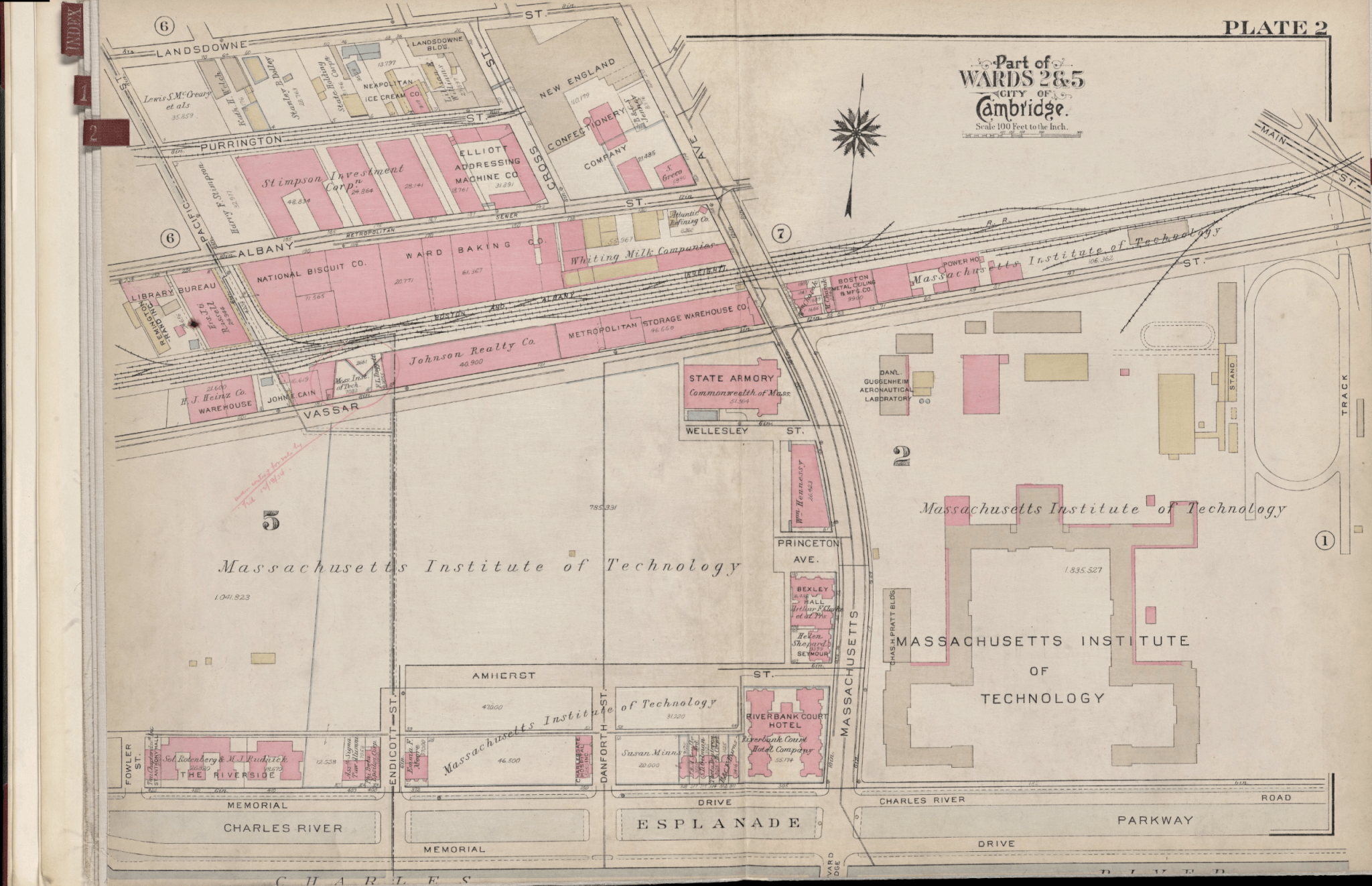
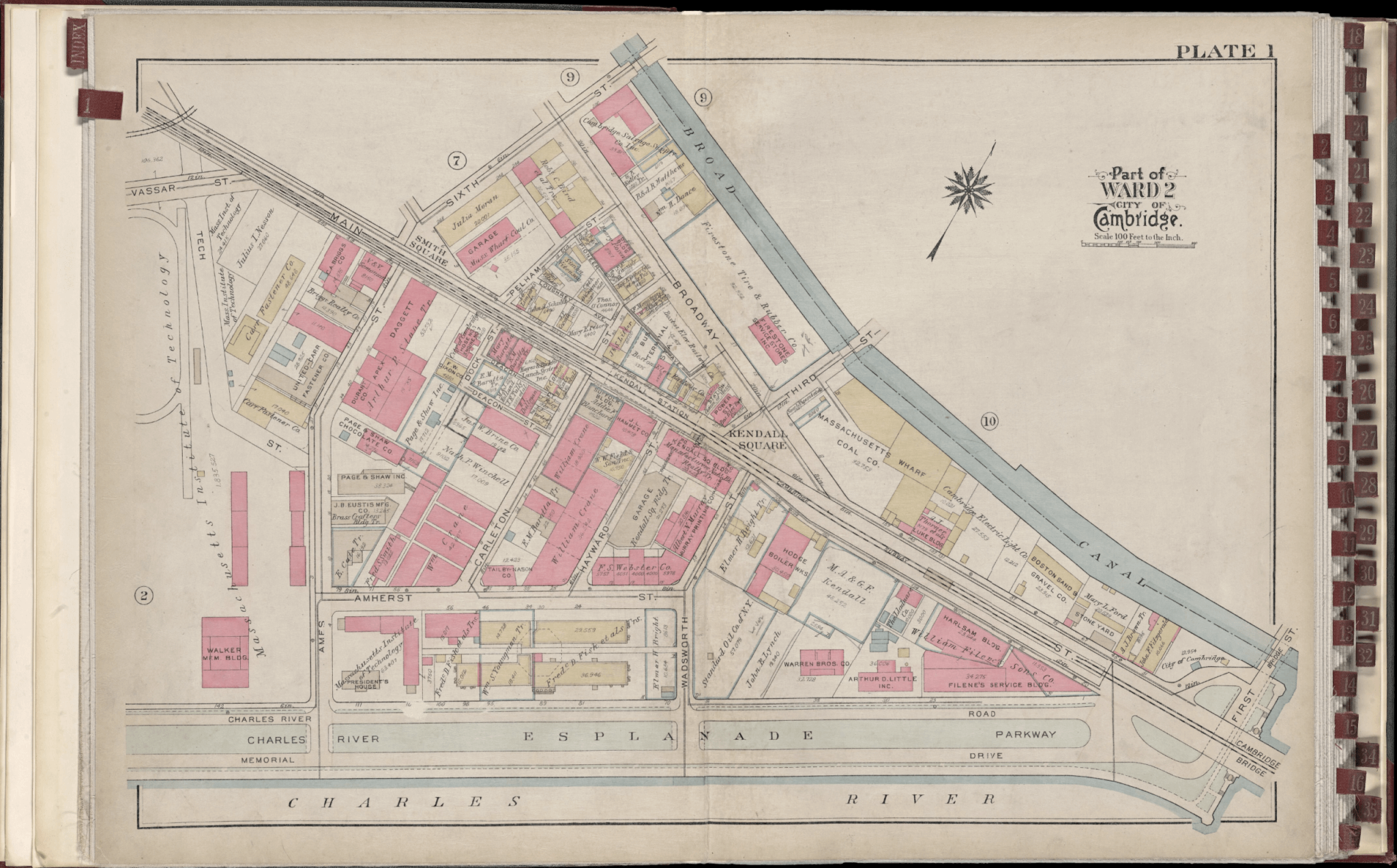
These plates depicting parts of the Kendall Square area are from the 1930 edition of the Bromley Atlas of the City of Cambridge (Norman B. Leventhal Map & Education Center Collection, Boston Public Library).
However, the post-war economy began to shift toward service and technology, and freight systems moved from rail to roads. Planners now viewed Kendall’s nineteenth-century infrastructure as an impediment. The Housing Act of 1949 had provided municipalities with the legal and financial machinery to designate such areas as “blighted.” The newly formed Cambridge Redevelopment Authority (CRA)—established in 1957— could pursue land acquisition of “blighted” areas through eminent domain. To the CRA and city leaders, Kendall Square was a diamond in the rough. Its proximity to downtown Boston, nearby highways, and a shared border with MIT made it the ideal site for a “modern” economic experiment.
The NASA Catalyst
Despite having the ingredients for an urban renewal project, the true catalyst for the Kendall Square Urban Renewal Plan was the Space Race. In the early 1960s, the federal government sought a location for a technologically sophisticated Electronics Research Center (ERC) for the National Aeronautics and Space Administration (NASA). The competition among regional municipalities was fierce, but Cambridge possessed a unique advantage. The city had the ability to use the urban renewal process to prepare a massive site with federal funding.
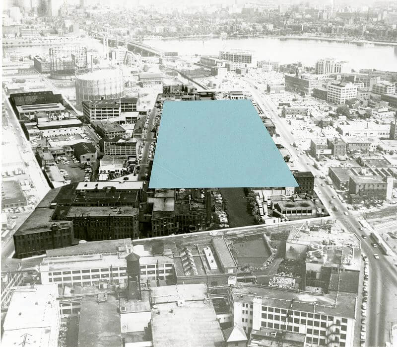
In 1964, the CRA presented a concept plan to the Cambridge City Council that integrated the NASA facility into a broader 43-acre renewal project. It was known as the Kendall Square Urban Renewal Area or KSURA. The plan was typical of urban design at the time. It favored the consolidation of small parcels into massive development blocks. Streets would also be widened to accommodate regional highway traffic. The plan also called for the creation of “towers in the park”—buildings set back from the street and surrounded by parking lots. This design was not merely aesthetic. It was an attempt to lure suburban workers and corporate interests into the city by replicating the ease of the suburban office park within the urban core.
By the time the plan received final approval from the city, state, and federal governments in 1965, the scope was clear. The site was divided into four primary parcels. Parcels 1 and 2 (totaling 29 acres) were reserved for NASA, while Parcels 3 and 4 (14 acres) were designated for private development. This partnership between the federal government and the municipality ensured that the CRA could move with a speed and authority that private developers could never match.
Resistance and the Shadow of the West End
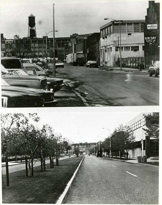
Implementation, however, required clearing the existing community. Between 1965 and 1970, the CRA initiated a period of aggressive land assembly. This involved the demolition of historic industrial buildings. Small-scale manufacturers and repair shops were also displaced. While Kendall Square had fewer residents than the West End, its social and economic impact was nonetheless significant. Local press coverage from the Cambridge Chronicle and the Boston Globe recorded a growing chorus of dissent. Small business owners argued that they were being sacrificed for the benefit of “top-down” institutional interests.
The resistance in Cambridge was fueled by a recent and traumatic precedent within eyesight: the West End. Residents and activists had watched the total erasure of that neighborhood just across the river only a few years earlier. The West End had become a rallying cry for the growing urban protest movement. Critics argued that the CRA’s plan would produce a sterile, automobile-oriented environment. It would kill the very street life that made Cambridge unique. This public opposition, combined with the complexities of relocating existing businesses, created a friction that slowed the project’s momentum. This prevented the kind of overnight demolition that had occurred in Boston.
NASA’s Exit and MIT’s Ascent
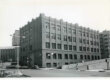
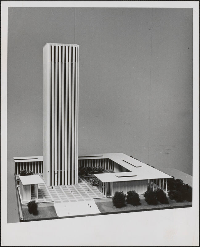
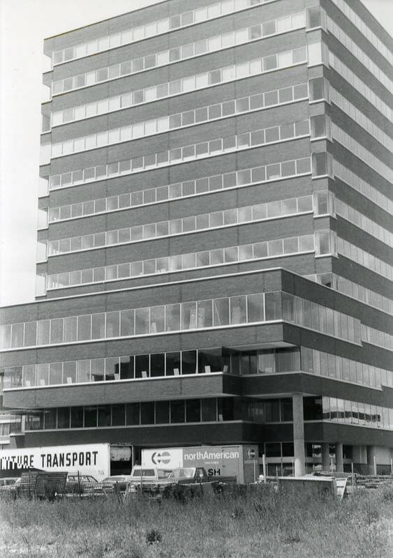
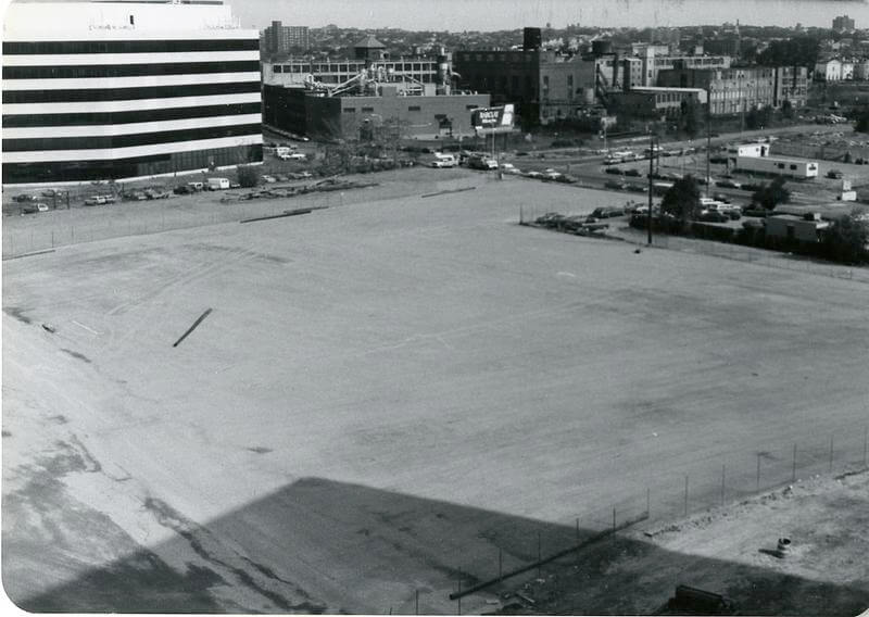
The most dramatic turning point in Kendall’s history occurred in 1969. Due to federal budget cuts and a shifting political landscape under the Nixon administration, NASA abruptly announced the closure of the ERC. The federal government, which had been the primary driver of the renewal plan, was pulling out. They left behind a 14-story office tower and several low-rise buildings on a largely cleared, 29-acre “urban desert.”
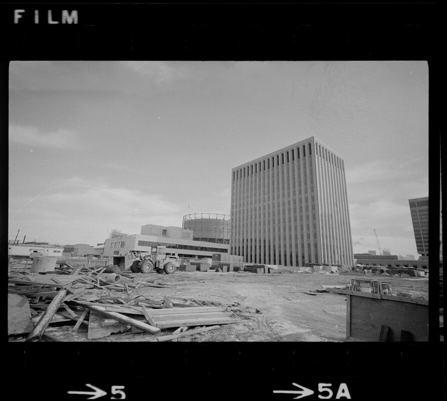
This vacuum could have led to a permanent blight, but it instead allowed for a more organic— and arguably more successful—evolution. With the federal government’s departure, the role of MIT shifted from a passive neighbor to a central player. By the mid-1970s, the Institute began working closely with the CRA and private developers to rethink the land use for the vacated NASA parcels.
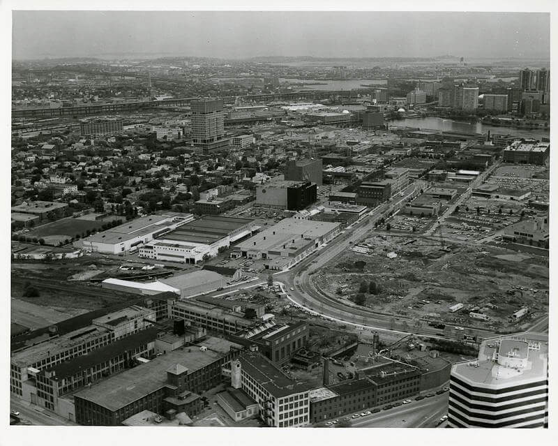
This transition was critical. The process in Kendall Square was unlike the West End. In the West End, the land was quickly filled with high-end residential towers that served as a wall against the rest of the city. In contrast, MIT’s involvement redirected Kendall Square’s development toward research and university-industry synergy. MIT’s presence acted as a magnet for early high-technology tenants and biotech pioneers. The “sterile” environment feared by critics began to be populated by labs and startups. These industries required the very large-scale floor plates and modern infrastructure that the urban renewal plan had created.
A Hybrid Legacy
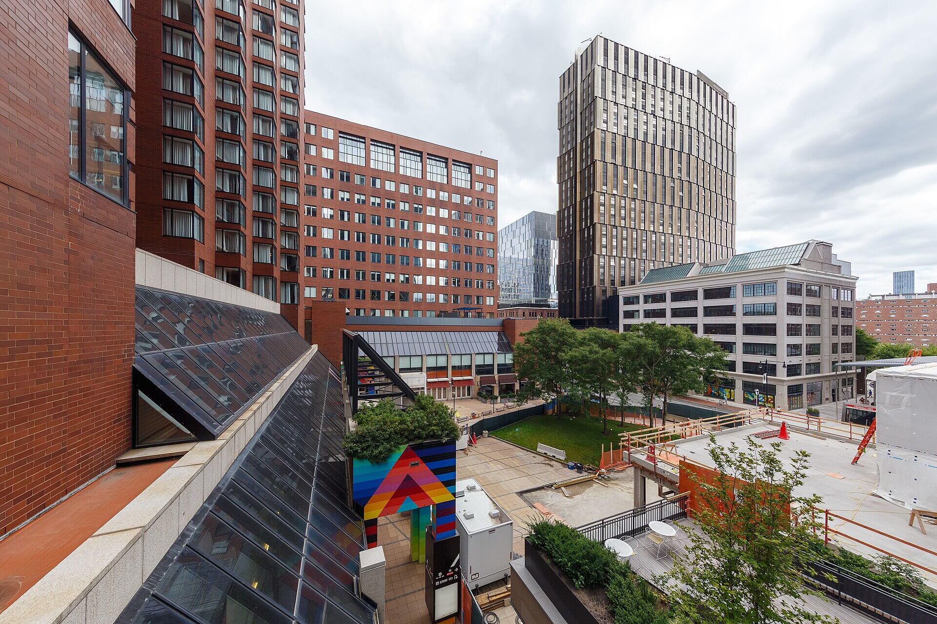
By the late 1970s, the physical groundwork of Kendall Square was complete, but the area remained a strange hybrid. It was a landscape of “patches”: sleek modern labs and vast parking lots sat adjacent to residual industrial fragments and vacant lots. Today’s technology hub was still decades away. But the institutional framework—the partnership between the CRA, MIT, and private capital—was firmly in place. The change in the project’s focus laid the foundation for Kendall Square’s present-day epithet as “the most innovative square mile on the planet.”
The Kendall Square Urban Renewal Plan illustrates the two sides of mid-century planning. On one hand, it was an undeniable act of destruction. The project erased a century of industrial heritage and displaced local residents and small businesses. Yet, the project’s delays and the eventual pivot to a research-based economy saved it from the stagnation that plagued many other renewal sites. It wasn’t finished on time or according to the original federal vision, so it had the flexibility to adapt to the burgeoning digital and biological revolutions.
In comparing Kendall to the West End, the primary difference in outcome lies in NASA’s desertion. While the West End was a quickly finished product of 1950s clearance, Kendall Square became a continuous process of 1970s and 1980s adaptation. It stands today as an example of the capacity of urban space to be remade for new economic forms, while also serving as a reminder of the historic urban fabric that was lost to make that future possible.
Article by Daniel Spiess, edited by Jaydie Halperin
Sources: Boston Globe, reporting on Kendall Square redevelopment hearings, 1964–1972; City engineering reports and CRA project files, 1965–1975, Cambridge City Department of Public Works records; Cambridge Chronicle, local reporting on CRA hearings, 1965–1975 | community coverage, mid-1960s to 1970s; Cambridge Redevelopment Authority (CRA), “Annual Report,” 1960, “Annual Report”, 1978, | Kendall Urban Renewal Study, 1962 | land acquisition files and meeting minutes, 1964–1972”| Testimony in public hearings (Cambridge City Archives); Lelund Cheung, “When a neighborhood is crowned the most innovative square mile in the world, how do you keep it that way?” (Boston.com, May 2, 2013); Commonwealth of Massachusetts Executive Office of Housing and Livable Communities, “Urban Renewal Plans in Massachusetts,” Updated May 2023; Dolores Hayden, The Power of Place: Urban Landscapes as Public History (Cambridge, MA: MIT Press, 1995); Housing Act of 1949, Pub. L. No. 81-171; MIT Institute Archives and Special Collections, “History of MIT and Cambridge,” 1950s–1970s | correspondence between MIT administrators and Cambridge planning officials, 1967–1974 | CRA disposition records and early tenant directories, Cambridge Business Directories Richard Sennett, The Conscience of the Eye (New York: Alfred A. Knopf, 1990); Thad Tercyak, “Kendall Square Urban Renewal Project: Initial Years, 1963-1982,” (Cambridge Civic Journal Forum, June 2013); Samuel Zipp, Manhattan Projects: The Rise and Fall of Urban Renewal in Cold War New York (New York: Oxford University Press, 2010).