
The Origins of the Beacon Hill Neighborhood: A Tale of Two Slopes, Part 1
Boston’s highest natural point, Beacon Hill, has long attracted attention and spurred the imagination of locals and visitors alike. The site of the young town’s warning beacon (thus the name), it would become Boston’s most prestigious neighborhood 200 years later. Today Beacon Hill still serves as the site of the Massachusetts government, one of Boston’s most well-heeled addresses, and a magnet for tourists.
The Lay of the Land
It may never be known why exactly William Blaxton chose to settle where he did. He built his cabin at the base of the central and tallest summit of the Trimountain, a three hill range on the Shawmut Peninsula. Reports on him offer no clues and his personal papers burned in a fire after his death. Most likely, the hill afforded him some protection from the elements, especially the brisk wind off the Charles River.
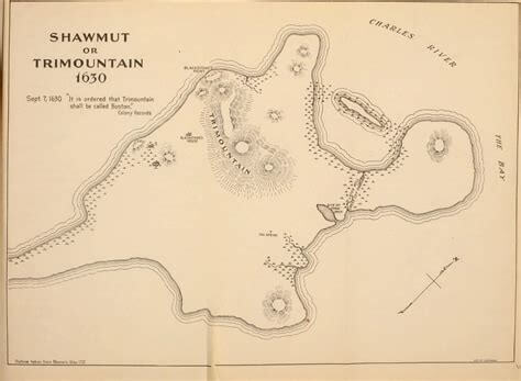
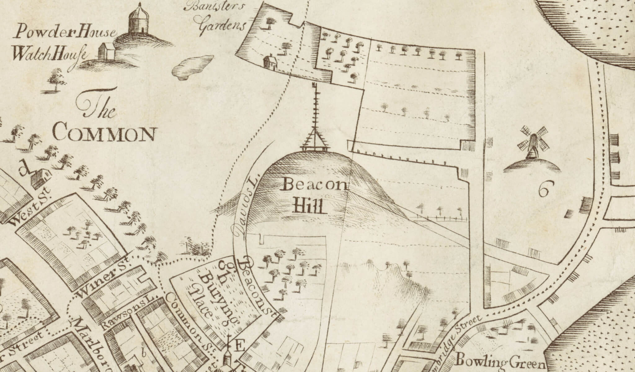
The Puritan settlers whom Blaxton invited to “his” peninsula recognized the strategic value of this hill. Its estimated elevation of 135 to 150 feet above sea level provided a great view of the surrounding area. Town officials named it Sentry Hill in 1634 and built a 60 foot beacon atop its summit as a warning system. This led to a permanent name change to Beacon Hill.
At the time, Beacon Hill, with its north and south slopes, was flanked by two other hills. On the east was Cotton Hill (renamed Pemberton), and to the west was Mount Whoredom (renamed Mount Vernon).
For about a century, serious home builders ignored the western half of the Shawmut Peninsula, including Beacon Hill. The hills were too steep, and the area between the Trimountain and the Mill Cove, known as New Fields, was too wild and marshy. Still, the town allotted or sold land there to early Bostonians who used their lots for pastures and orchards. There “cattle and horses grazed among the blueberry and barberry bushes, or lolled in the hot days under the shade of the elms.” Some found a commercial use for their property. Ropewalks were a common site on and around Beacon Hill.
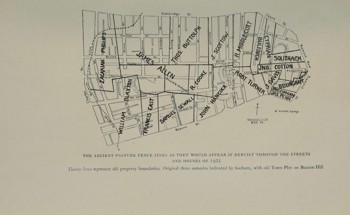
Until the late 18th century, land use around Beacon Hill went relatively unchanged. It was marked by constant exchanges of lots by families like the Hancocks, Allens, Phillipses, Bulfinches, Pinckneys, and Copleys. Thomas Hancock, the uncle of John Hancock, built one of the first homes on the southern slope of Beacon Hill in 1737. Jonathan Blanchard designed Hancock’s manor house on the current site of the Massachusetts State House.
Settling of the North Slope
The mid-18th century brought important changes that would shape the socio-economic dynamics of Beacon Hill for the next 200 years. The abolition of slavery in Massachusetts in 1789 attracted Black people from other states to Boston. They joined a modest population of Black Bostonians, most of whom lived in the increasingly crowded North End.
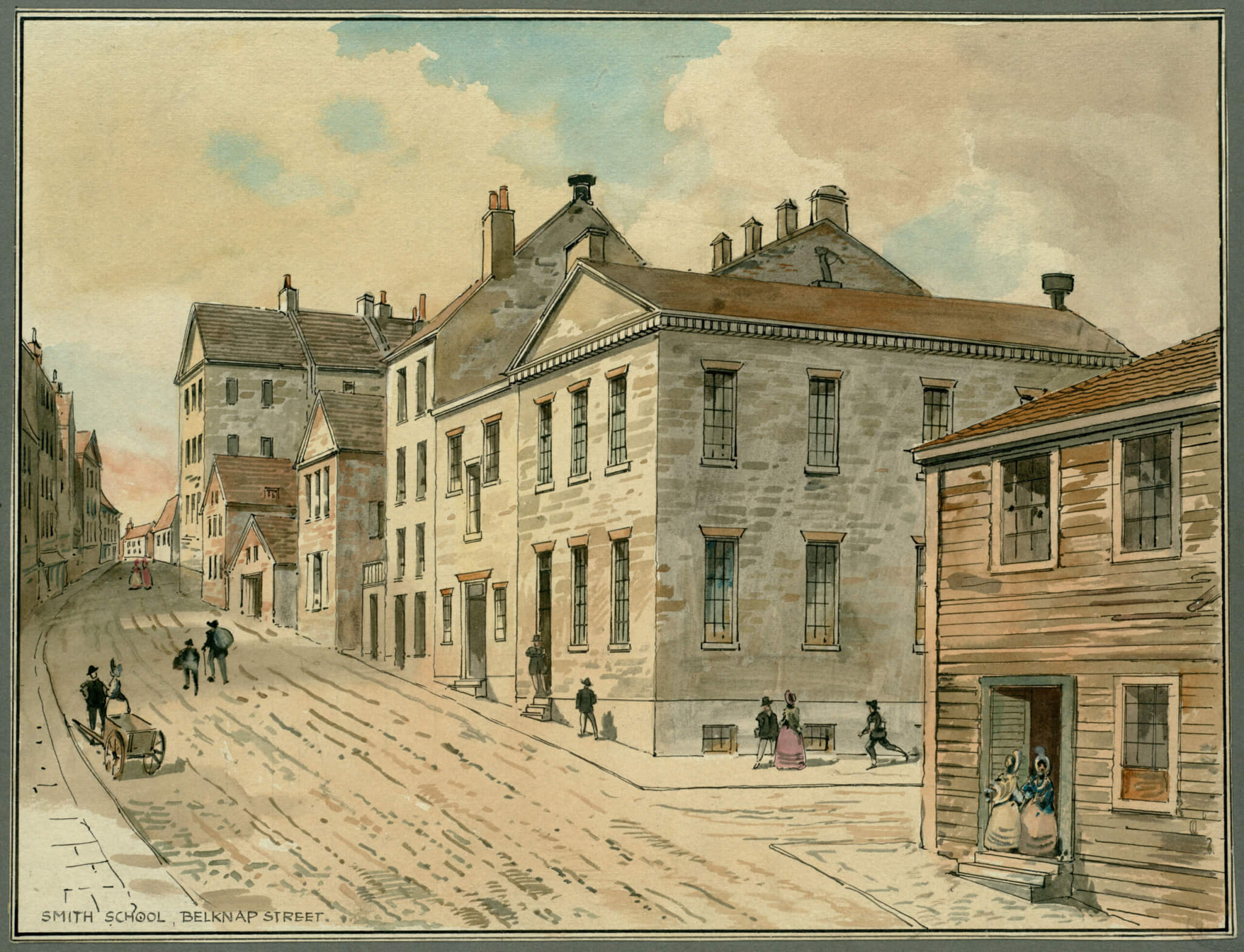
In need of more space, this small Black community turned to the neglected North Slope of Beacon Hill. The North Slope ran north from Pinckney Street to Cambridge Street and east from Belknap Street (now Joy) to the mudflats along the Charles River. It, along with adjacent Mount Whoredom, was dotted with distilleries, taverns and brothels. Ignored by most Bostonians as a disreputable district, Black Bostonians saw it as a place of opportunity. Here they would build wooden houses, churches, and schools. They created a vibrant community lasting over 100 years which became the heart and soul of the abolition movement.
The South Slope
Development of the South Slope, from Pinckney Street to Beacon Street and west to the river, looked quite different. Like Thomas Hancock, some wealthy Bostonians bought land and built a few houses along Beacon Street across from the Boston Common. The steepness of the Hill hampered any serious development upslope. Land owners, including the heirs of John Hancock, petitioned the town, unsuccessfully, to cut down the peak to make better use of their investments.
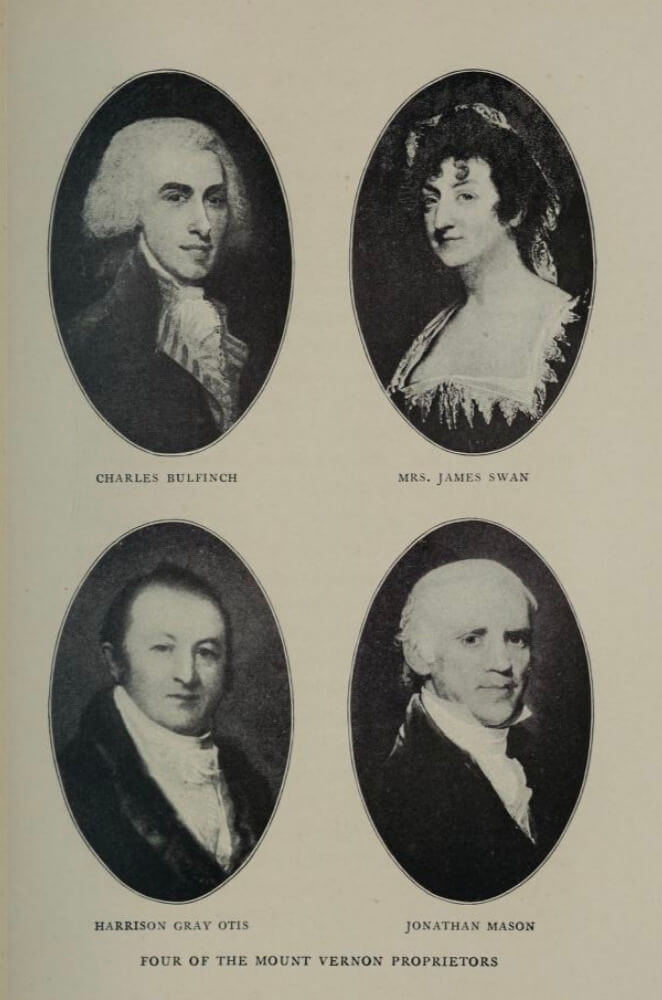
The catalyst for development came in the 1790’s with the planning of the new Massachusetts State House. One of the planning committee members was an ambitious 28-year-old lawyer and businessman named Harrison Gray Otis. Armed with insider information about the State House project, he formed a group of investors in 1794. The original members included Charles Bulfinch (architect of the new State House), William Scollay (namesake of Scollay Square), and Jonathan Mason (lawyer and politician). They were later joined by Mrs. James Swan when Scollay dropped out. The group called themselves the Mount Vernon Proprietors. They formed a plan to build “handsome, convenient, and capacious streets” surrounding the newly constructed seat of government.
Building an Elite Neighborhood
The Mount Vernon Proprietors began buying all the land they could around Beacon Hill, even before construction of the new State House. Purchases included a large tract owned by John Singleton Copley. Copley, a renowned portrait artist and British loyalist, had fled Boston for England in 1774. The acquisition of property presented the Proprietors with years of legal problems. One issue was the availability of valid deeds amongst sellers, many of which had been lost or destroyed in fires over the years. Additional hurdles included the economic effects of the War of 1812 and two depressions. The project dragged on for thirty years.
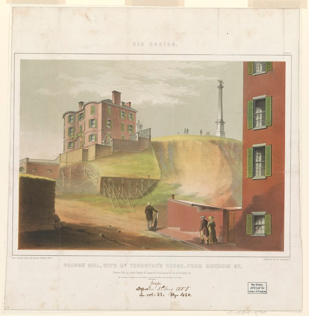
The project required massive site preparation. Engineers had to level the summits of both Mount Whoredom and Beacon Hill. Immediately after purchasing Mount Whoredom, Otis and company renamed the notorious hill Mount Vernon to make the land there more marketable. In 1803, they demolished what wooden structures remained, and effectively tore down the hill. Contractor Timothy Hunt lowered material taken off the top of the hill using a simple gravity railway system. Workers used the material to fill in the mudflats leading to the Charles River. This stretch of newly created land would become Charles Street. The Proprietors began removing 60 feet off the cap of Beacon Hill in 1810. The summit was located “between present Mt. Vernon and Pinckney Streets, a little east of what is now Louisburg Square”. That material was brought down the North Slope to fill the Mill Pond.
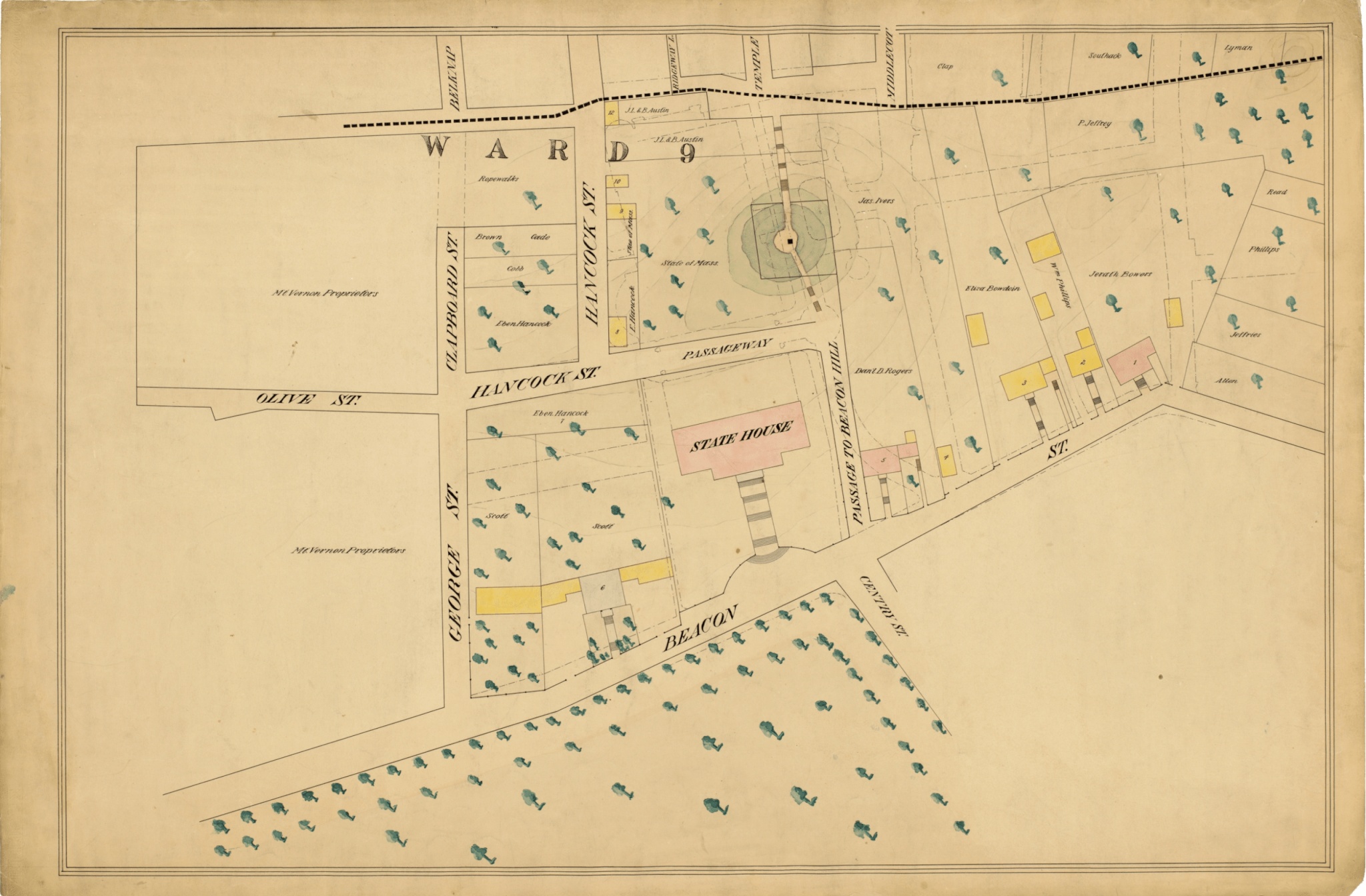
Though Bulfinch, ever plagued with financial troubles, dropped out of the project as an investor, he remained as a designer. He created the street layout and built a number of homes alongside his former students, Alexander Parris and Asher Benjamin. To encourage sales, both Otis and Mason built mansions on Beacon Hill. Otis built two, both designed by Bulfinch. The first was at 85 Mt. Vernon Street, the second at 45 Beacon Street which Otis and family lived in from 1805 until Otis’ death in 1848.

Despite the enormous investment in land and site preparation, and the economic swings that at times threatened the scheme’s success, the Mount Vernon Proprietors reaped a healthy profit. For a time, Beacon Hill would become the most fashionable address in the city.
Article by Bob Potenza, edited by Jaydie Halperin
Sources: Thomas Coffin Amory, “William Blaxton”, The Bostonian Society Publications Volume I, 1886-1888, 1880; Allen Chamberlain, Beacon Hill: Its Ancient Pastures and Early Mansions (Boston: Houghton Mifflin, 1925); Boston Public Library; Walter Irving Firey, Land use in Central Boston, (Cambridge, MA: Harvard University Press, 1947); Clifford A. Kaye, “The Geology and early History of the Boston Area of Massachusetts, A Bicentennial Approach”, Geological Survey Bulletin 1476; Samuel Eliot Morison, Harrison Gray Otis, 1765-1848: The Urbane Federalist, (Boston: Houghton Mifflin, 1969; Leventhal Map Center of the Boston Public Library; Nancy Seasholes, Gaining Ground, (Cambridge, MA: MIT Press, 2003, 2018); Annie H. Thwing, The Crooked and Narrow Streets of Boston, (Boston: Marshall James Company, 1920); United States Department of the Interior National Park Service, “National Register of Historic Places Inventory – Nomination Form; Beacon Hill Historic District”, 1970; Walter Muir Whitehill, Boston A Topographical History, (Cambridge, MA: Belknap Press of Harvard University Press, 1959).