
Redeveloping the Seaport, Part 2: When Rent and Water Rises
Rebranded as an “Innovation District” and filled with new glass and steel towers, the Seaport has become a financial asset to the city. Yet, the neighborhood is highly racially and economically segregated. And what happens if sea level rise puts Boston’s most expensive neighborhood underwater?
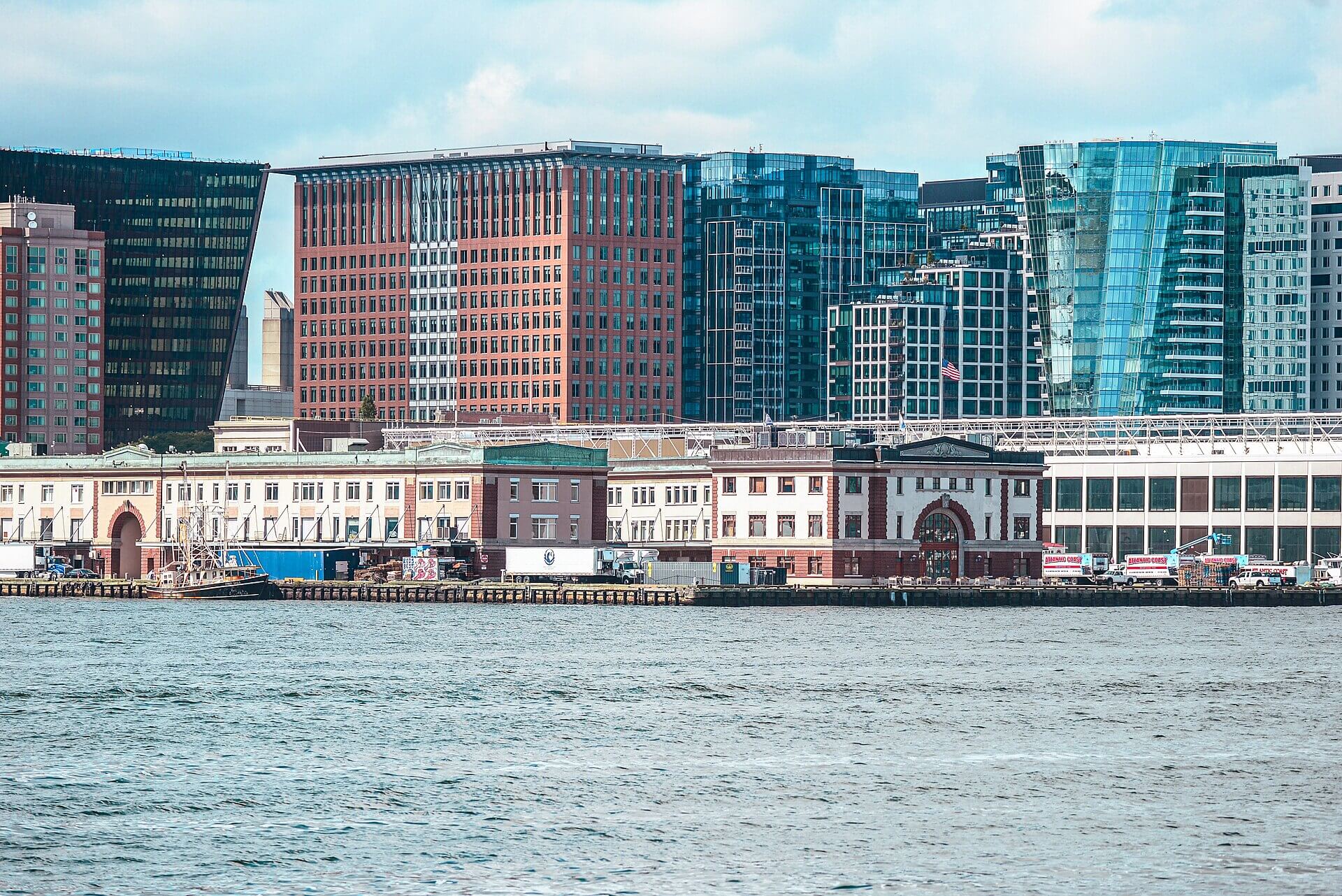
Now filled with glass towers, international corporations, and affluent white collar workers, the South Boston Waterfront was set up to be Boston’s latest successful neighborhood. However, the whole picture is far more complicated than the shiny new buildings would indicate.
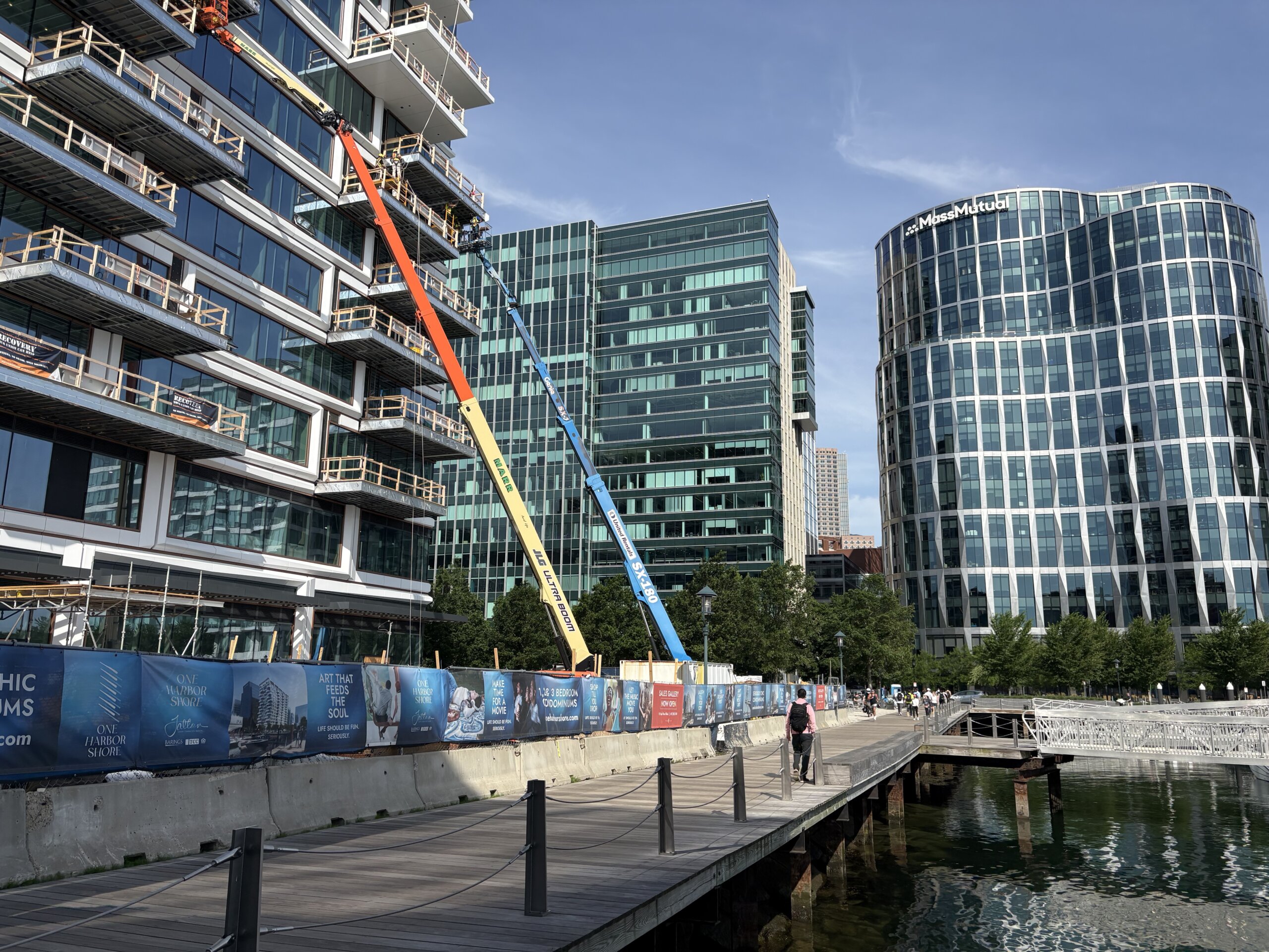
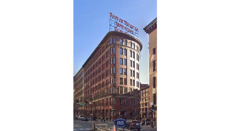
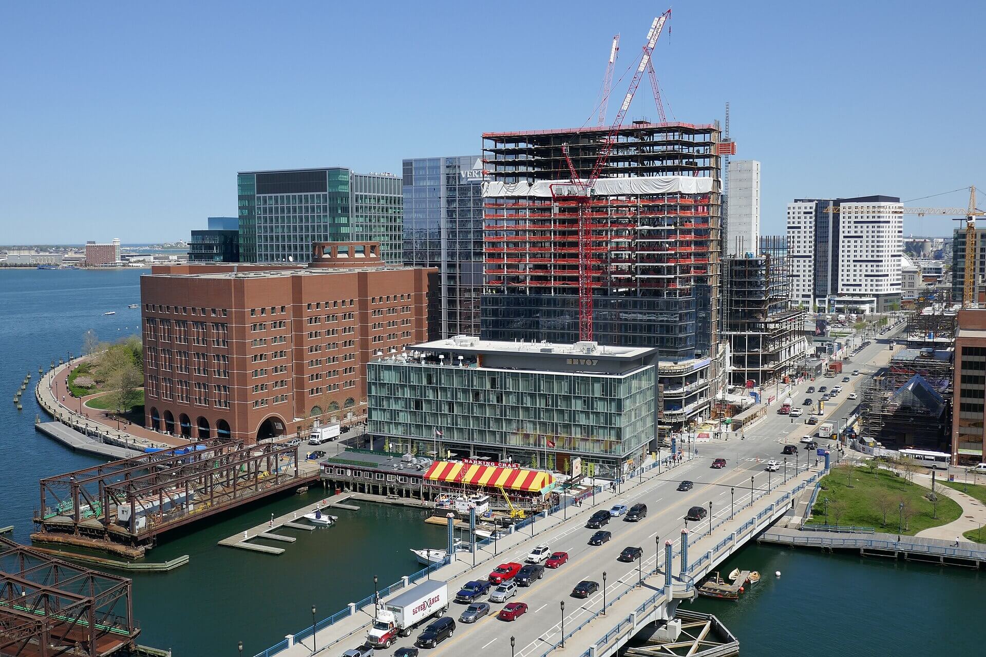
The Seaport is still under construction. There are projects in various stages of development all over the neighborhood. For example, 320 Summer Street and 259-267 Summer Street are undergoing renovation in 2026. Construction will convert these office buildings into multi-family homes and mixed-use developments. These buildings are both part of the City’s Downtown Office to Residential Conversion Pilot Program.
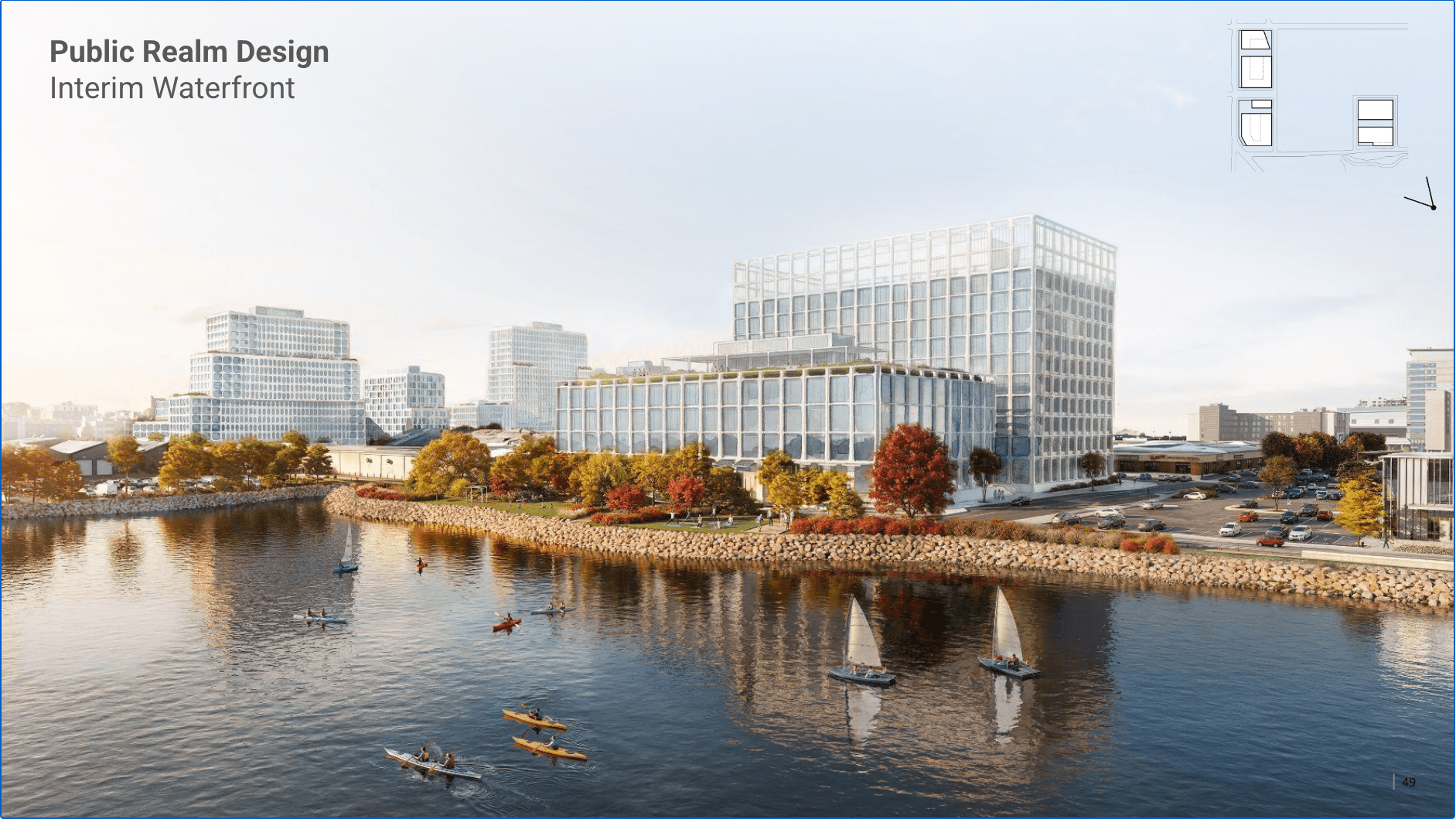
The proposed project at 300 West First Street plans to build 1.7 million square feet of commercial, research, civic, and residential space. This would include space for a ground floor grocery store. While buildings are still rising into the sky, the character of the district has already become clear.
Is the Seaport for Everyone?
In 2026, the Seaport represents a staggering 10% of the City’s property tax base, or $343 million. This is despite making up less than 4% of the City’s land and 1.2% of the City’s population. The Seaport redevelopment was a massive financial success for Boston’s municipal government. Over the course of a few decades, the city went from being at risk of financial collapse to seeing increased revenue and a hopping economy. The Seaport sees a high volume of tourists who come to enjoy the harbor side views and trendy businesses. Wealthy owners pay high property taxes on their pier-side apartments.
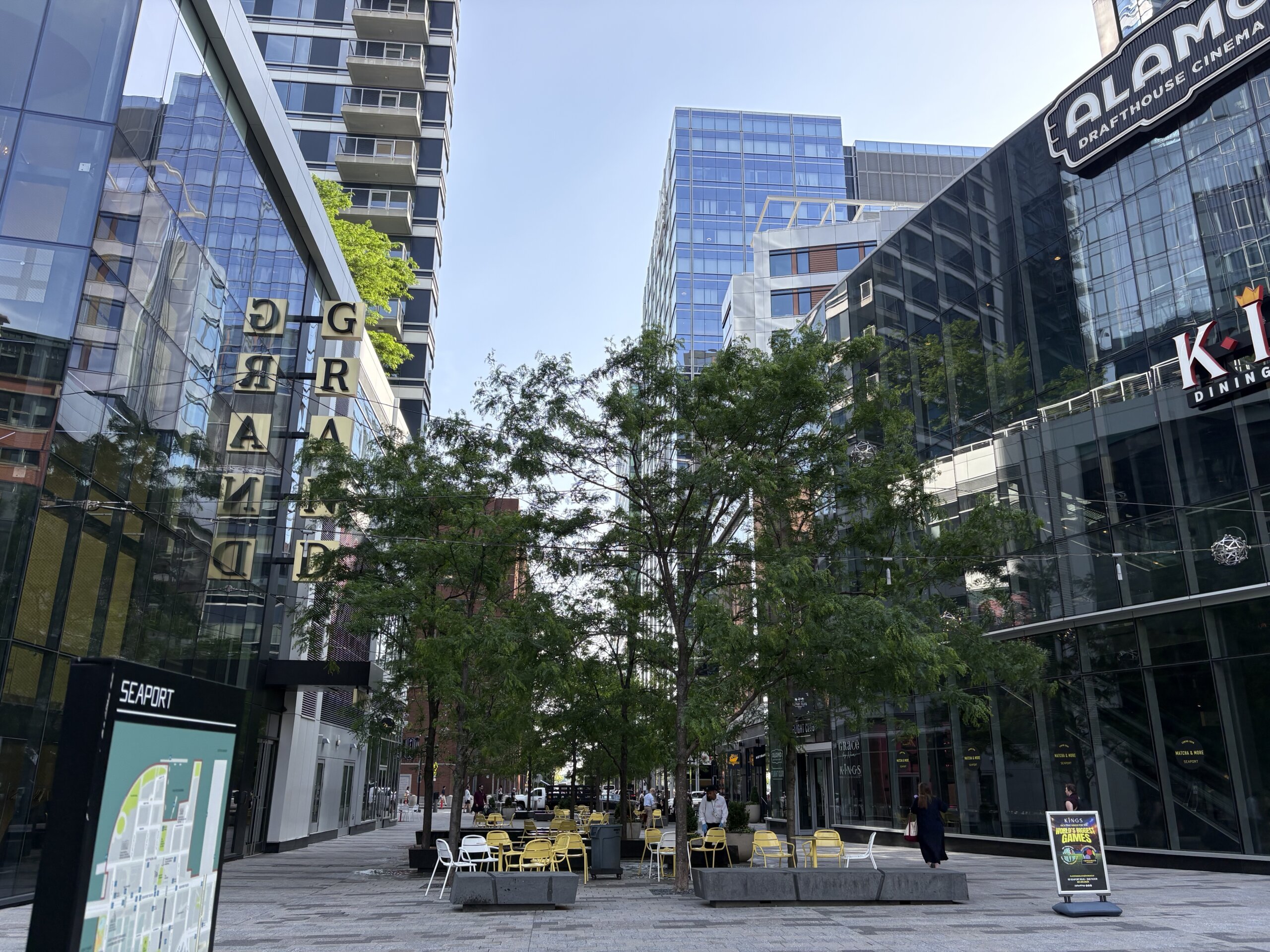
However, the Seaport has become a place where many Bostonians don’t feel welcome. As a mayoral candidate in 2021, Michelle Wu said, “The Seaport is one of the starkest examples of what’s wrong with our development system overall.” Despite its positive effect on the City’s purse, the Seaport has many social issues. As of 2026, it has become de facto segregated by race and class. Developers and businesses received tax subsidies paid for by the whole city. Yet after Boston’s less wealthy and non-white communities helped pay for the Seaport, they were mostly excluded by price from the finished neighborhood and have not reaped its benefits.
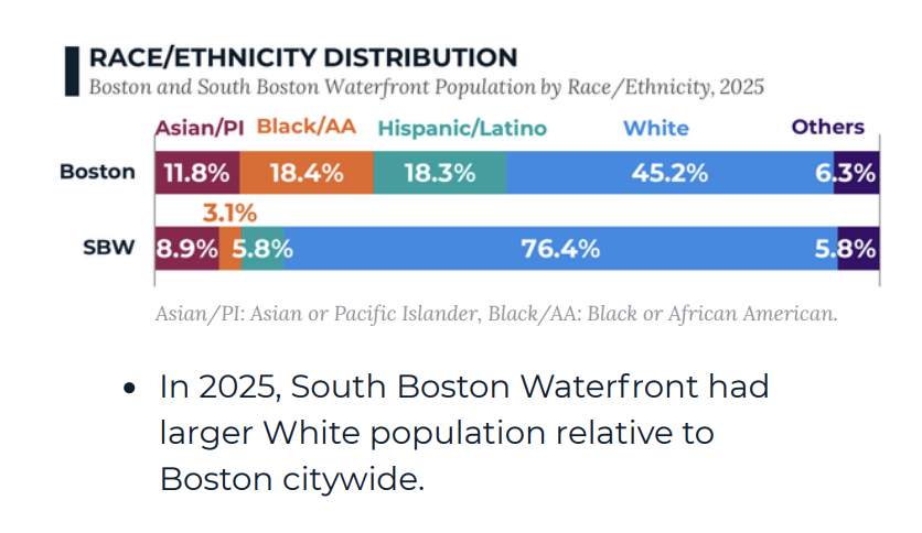
The Seaport’s population has double the median income relative to the rest of the city. As of 2025, 93.2% percent of Seaport residents have Bachelor’s degrees, compared to 55.7% for the rest of the city. It is also the least racially diverse neighborhood, despite being the newest. In a city that already suffers from intense racial segregation, 76.4% of the Seaport’s population is white, and only 3% is Black. Additionally, many wealthy Seaport homeowners use their homes as “wealth storage units.” These buyers do not use the home as their primary residence. Instead they use it as an investment, accruing equity over the years. This leaves a unit of housing empty or rarely used in a city struggling to provide enough housing.
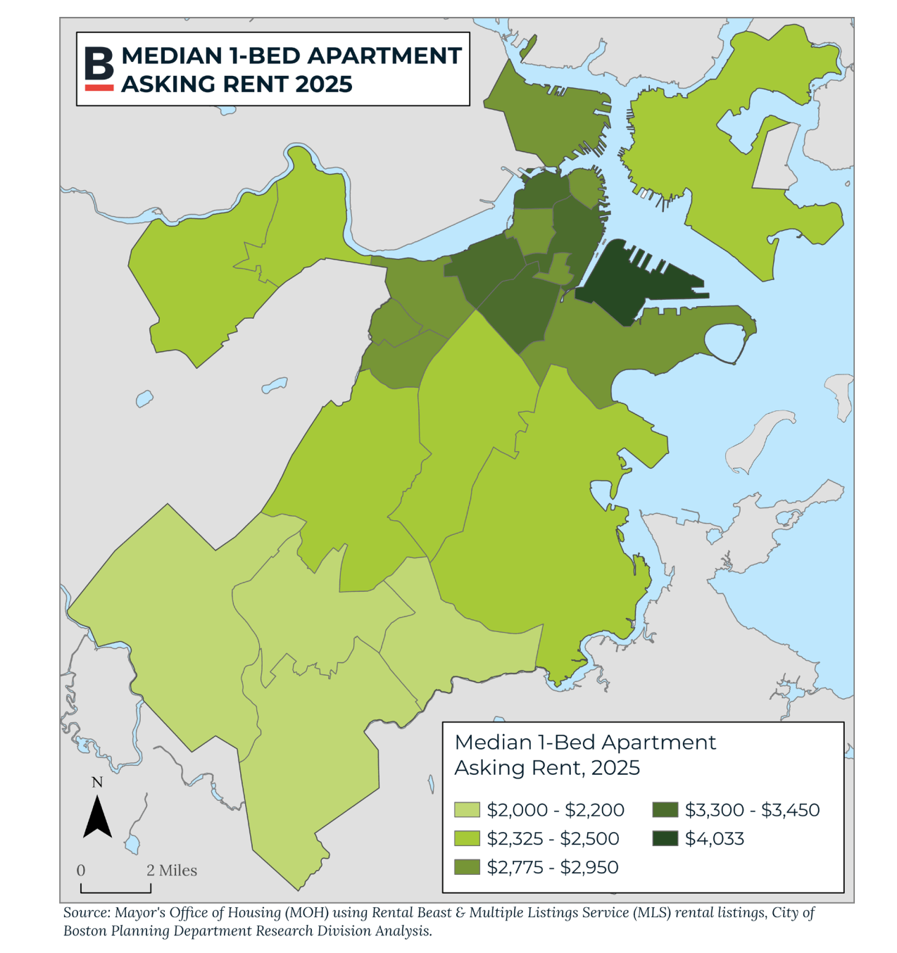
The development of the neighborhood has arguably had a gentrifying effect on South Boston and the city as a whole. The development of the Seaport affected real estate prices in South Boston. Traditionally a low-rent working-class neighborhood, Southie rents grew at a much higher rate than the rest of the city. As the land in the Seaport becomes more expensive, nearby areas become attractive as well. Today, South Boston as a whole has gentrified.
The Seaport has limited green spaces (e.g. parks) and civic spaces (e.g.libraries). Transit connections are sparse and it is more car-centric than other neighborhoods. While the Silver Line runs in the Seaport in an underground Bus Rapid Transit tunnel, it does not carry as many passengers as rail. The lack of transit contributes to the inaccessibility of the neighborhood to less affluent Bostonians.
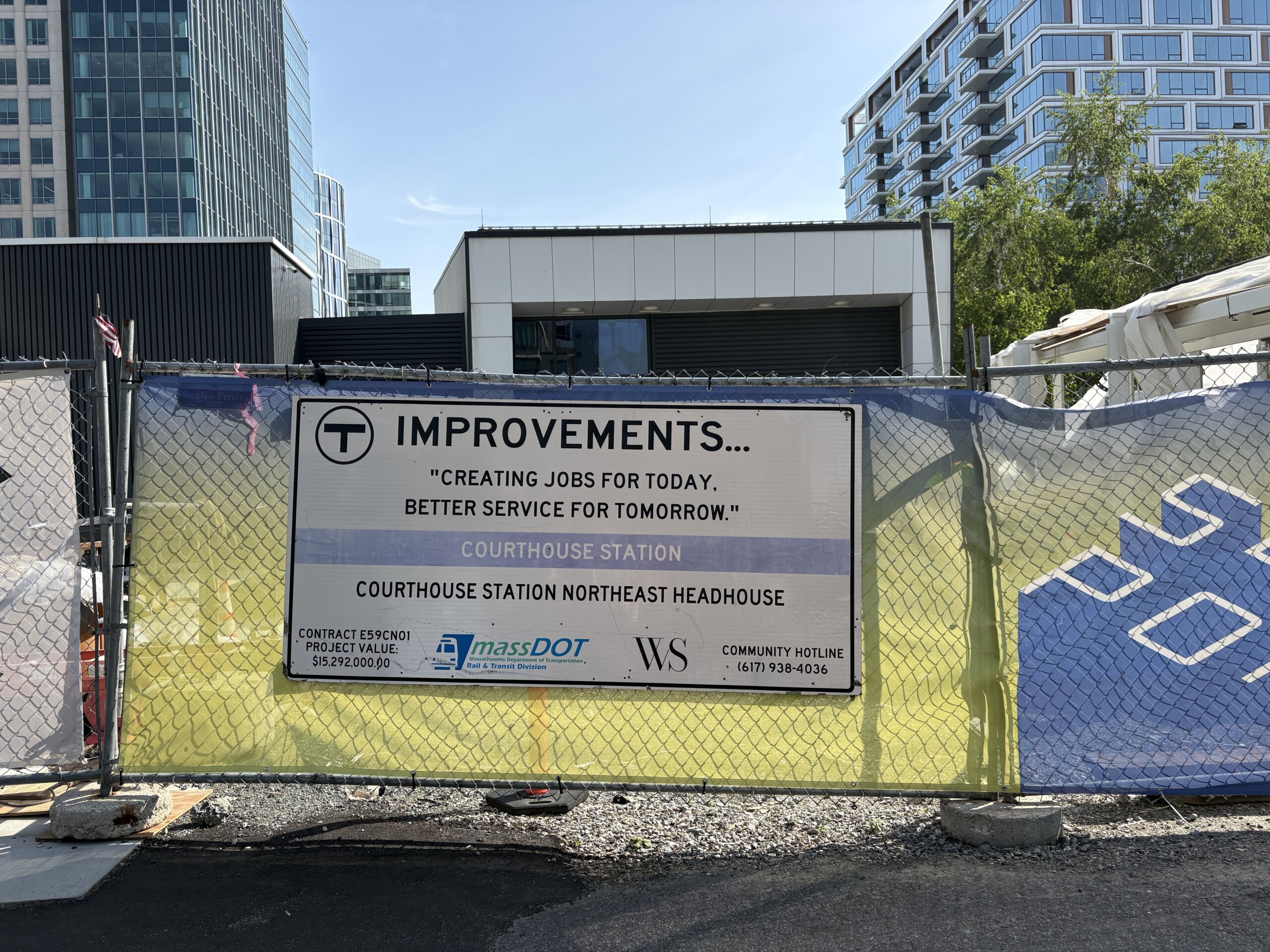
Officials proposed an MBTA line, the Indigo Line, to run through the neighborhood in the 2010s. However, the plan was axed by the Baker administration. Trendy corporate chains and luxury brands make the neighborhood attractive to tourists. At the same time, small local businesses cannot afford the Seaport’s exorbitant rents. Thus large chains are generally the only businesses able to flourish there.
Plans From the Past and For the Future
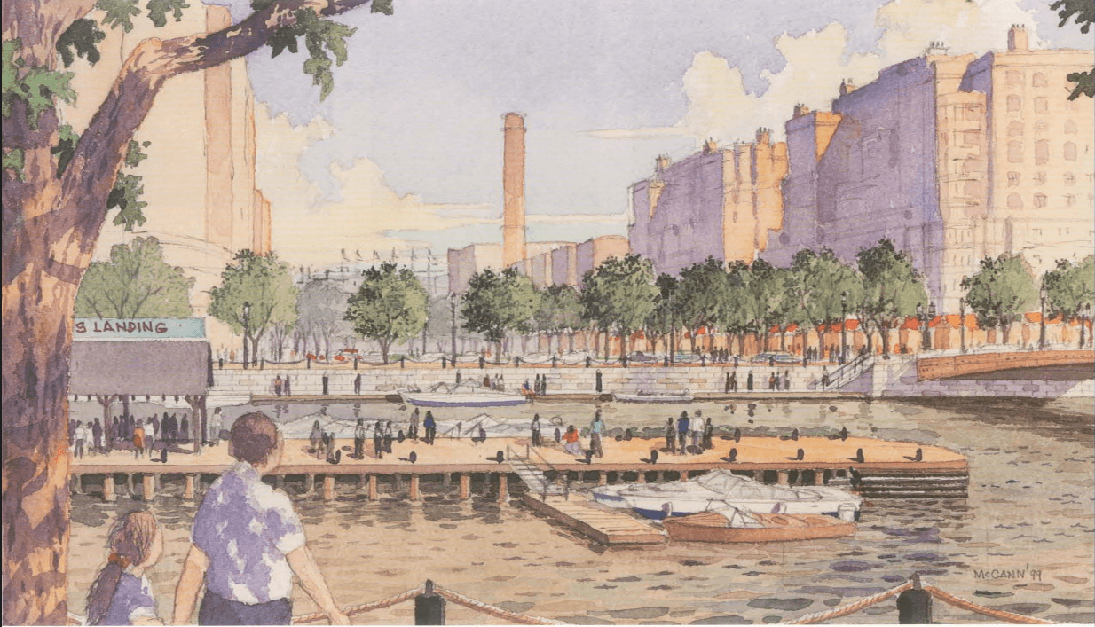
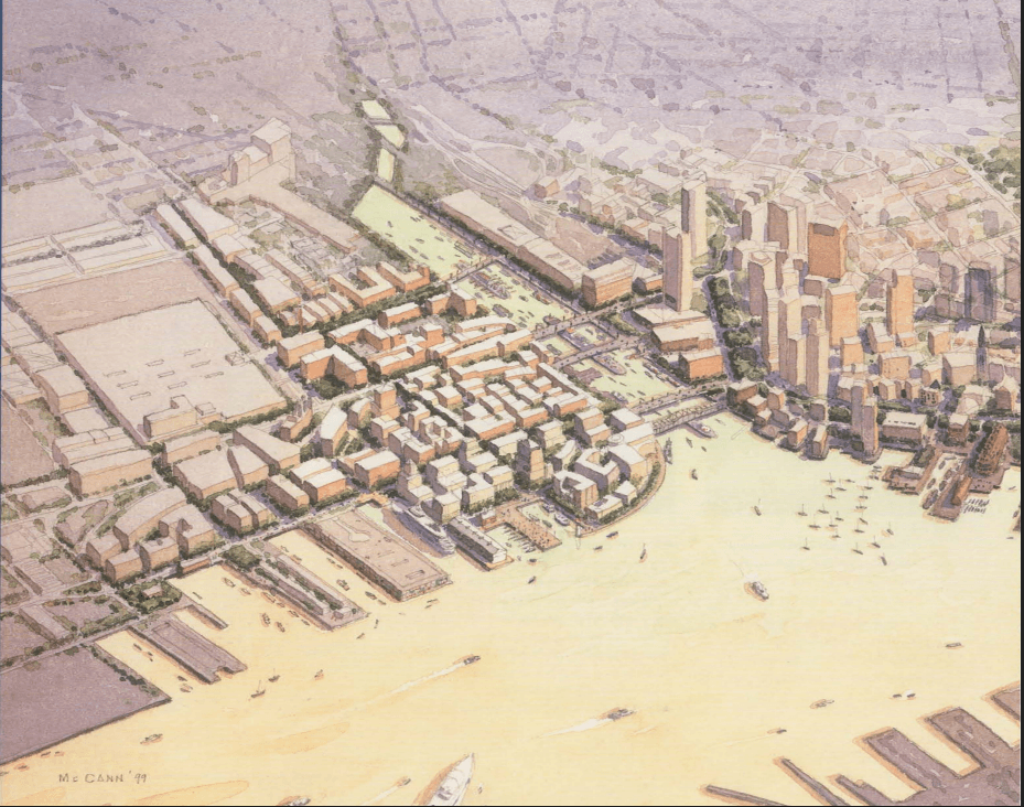
While the Seaport is a financially and physically inaccessible neighborhood, it wasn’t intended to be like this. In the 1999 plan for the neighborhood, the Seaport was designed to be far more reminiscent of the rest of Boston. It would have had smaller blocks, a 150-foot height limit, street trees, a network of small parks, and distinct neighborhoods.
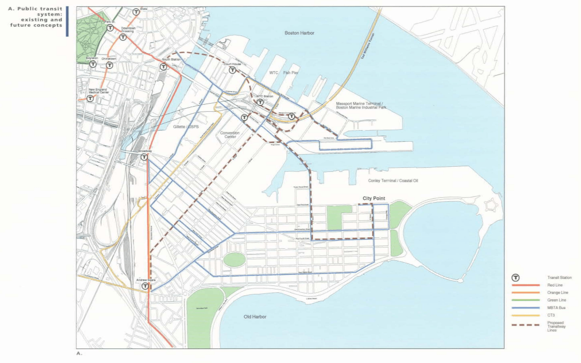
Additionally, Mayor Thomas Menino believed “that no less than one out of every ten new homes” in the Seaport needed to be affordable to “create a real neighborhood that will raise the quality of life” in Boston. The 1999 plan highlighted the high cost of living in Boston as something Seaport development should address. Unfortunately, this vision of the Seaport was never implemented. According to writer James Howard Kunstler, this was due in part from opposition from local South Boston politicians and less state funding after massive spending on the Big Dig.
Finally, Seaport faces an existential threat: rising sea levels. The vast majority of the neighborhood will be vulnerable to the impacts of sea level rise by 2050. According to a July 2026 draft plan from the US Army Corps of Engineers (USACE), Boston could see up to four feet of sea level rise by 2090. This could cause up to $54 billion in damages by the end of the century.
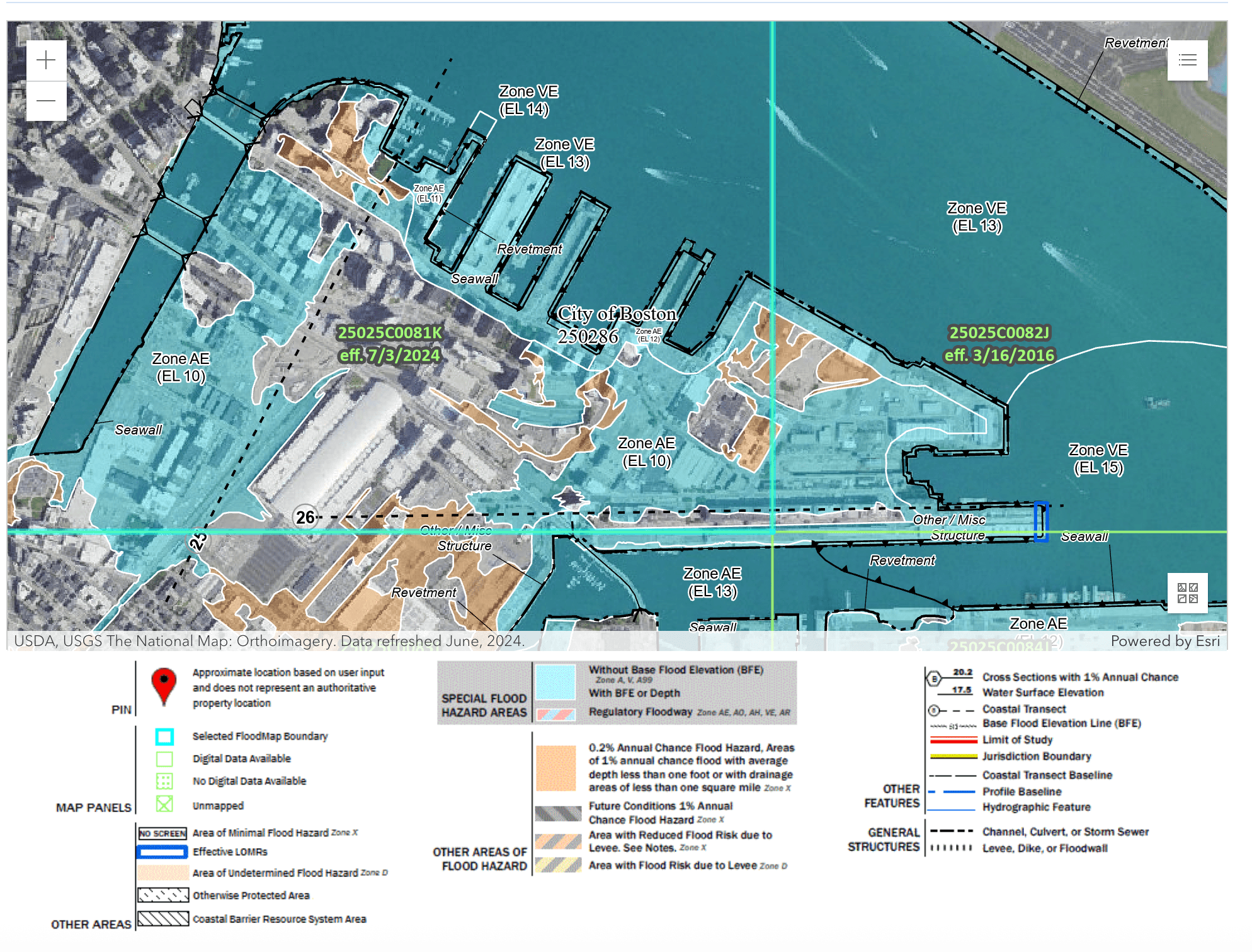
Many individual buildings in the Seaport have improved their climate resiliency. Still almost the whole neighborhood (99% of buildings) is within the 100-year floodplain. This means there is a 1% annual chance of flooding for the whole neighborhood. Individual buildings might withstand flooding. Yet, if the infrastructure of the neighborhood is at risk that will mean little. The lobby of a luxury building might be designed to withstand flooding, but can residents get to the grocery store? Without investment in infrastructure, floods will make the neighborhood even more inaccessible. According to the USACE, it will cost approximately $10 billion for infrastructure to close Boston’s coastal flood pathways. This expense would prevent massive damage and potential loss of life.
Critics point out that this fatal flaw should have been addressed early on. The risks of rising sea levels were well known by the time many Seaport buildings were under construction. Designers could have elevated the whole neighborhood through landfill or constructed sea walls. Yet they chose not to do so to save on upfront costs. How much of this $10 billion investment would be necessary if it had been “water-proofed” 20-30 years ago? Since a significant chunk of the municipal budget comes from the Seaport, the city must innovate to keep from going under water, literally and figuratively. If the infrastructure of the Seaport were reworked, however, that would mean even more investment into an already wealthy area. This would compound the costs of the Seaport’s development for Boston’s low income communities.
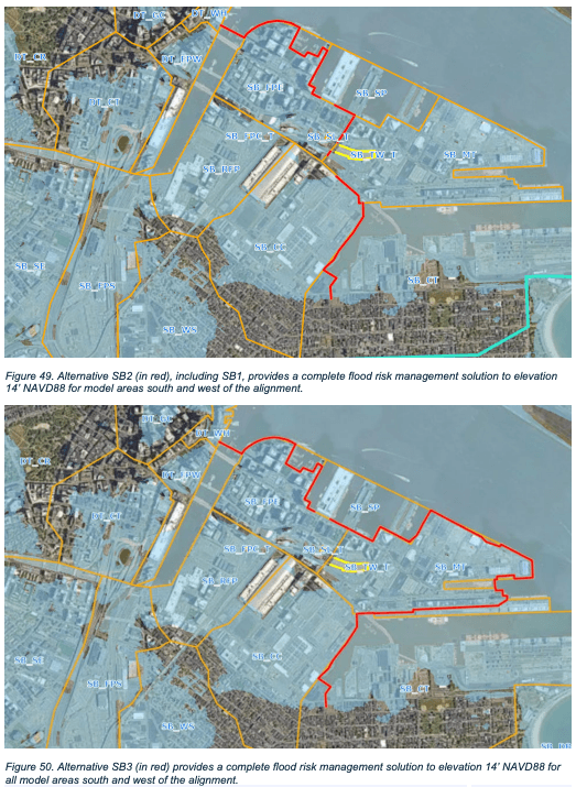
The process of developing the Seaport has raised concerns about uneven results by race and class. Boston and Massachusetts taxpayers, including low income and non-white residents, shouldered hundreds of millions in tax breaks to invite businesses to the Seaport. The Seaport district has buoyed the city’s finances, but Bostonians subsidized the private development of the Seaport. They helped build a neighborhood they could not afford, could not easily access via transit, and that might be under water by the end of the century.
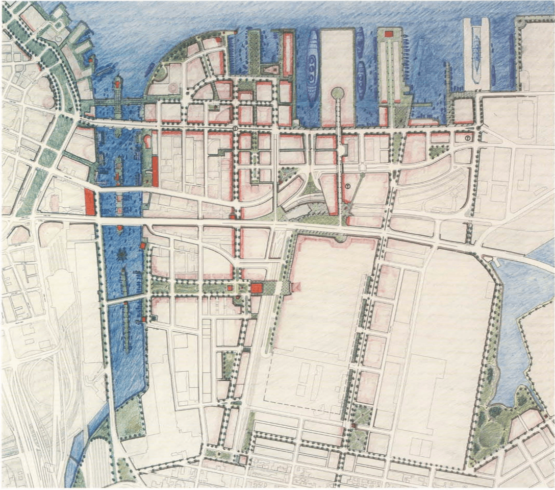
Boston created the Seaport from scratch. The original plan called for affordable housing, transit accessibility, and green spaces. However, this noble vision of the neighborhood went by the wayside. Developers primarily built luxury housing when outside sources of money dried up in the 2000s. The South Boston Waterfront was an opportunity to create a neighborhood without displacement. However, many Bostonians resent the missed opportunity it represents, which they financed. The city, intentionally or not, created a neighborhood for corporations and for the wealthy. How much more likely is the average Bostonian to visit the neighborhood today than thirty years ago, never mind live there? Moreover, the city and taxpayers will likely have to bail the Seaport out from the effects of rising seas. The Seaport may no longer be the “blighted” sea of parking lots and empty wharves, but if left unchecked it will likely soon be underwater. And Boston’s budget could sink along with it.
Article by Nick LaCascia, edited by Jaydie Halperin
Sources: Boston Landmarks Commission, “The Fort Point Channel Landmark District Study Report,” (Environment Department, City of Boston, December 9, 2008); Catherine Carlock and Yoohyun Jung, “Water is coming for the Seaport; the whole city will be poorer for it” (The Boston Globe, October 28, 2025); City of Boston, “USACE Draft Integrated Feasibility Report: Boston CSRM” (July 30, 2026); City of Boston Planning Department, “Neighborhood Profile: South Boston Waterfront,” (2025) | “Boston’s Economy 2026” | “Boston in Context: Neighborhoods | Boston’s Population by Neighborhood as of January 1, 2025”; Nick Collins and Linda Corcena Forry, “Opinion: Making the Seaport accessible to all,” (The Boston Globe, December 29, 2017); Sam Drysdale and Colin A. Young, “Toy maker Hasbro announces HQ move to Boston from Rhode Island,” (WBUR, September 8, 2025); Keira Dubitsky, Lily Ornstein, and Katie Kissell, “Inequality in Boston’s Seaport District” (December 5, 2022); FEMA, “FEMA Flood Map Service Center: Search By Address | Search Query Boston”; Paul Kirshen et al. “Feasibility of Harbor-wide Barrier Systems,” (Sustainable Solutions Lab, UMass Boston, 2018); Letters, “Boston’s Seaport District: a gleaming disappointment,” (The Boston Globe, February 6, 2021); William Nicholson, “Seaport District, Boston, MA” (Hansen Geography Project, Macalester College, 2023); Jesse Remedios, “The Seaport Cost Billions To Build. What Will It Take To Save It?” (WBUR, June 16, 2021); Matthew Robare, “Boston’s Costly Missed Opportunities” (Strong Towns, January 5, 2021); USACE, “Boston Coastal Storm Risk Management Study: Coastal Engineering Appendix” (July 2026).